
Type Rural road | Length 1,344 km (835 mi) | |
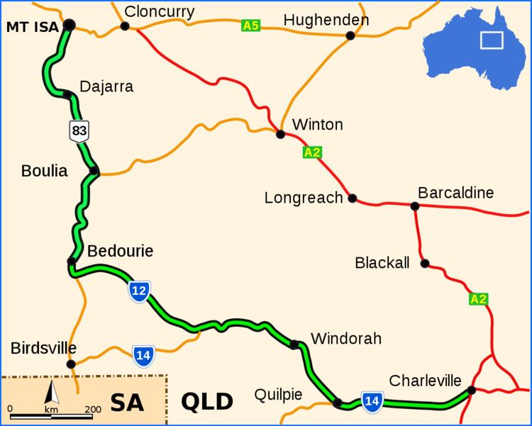 | ||
The Diamantina Developmental Road is a gazetted road entirely in Queensland, that runs from Charleville in the south-central part of the state to Mount Isa in the north-west.
Contents
Route description
The road passes through the towns of Quilpie, Windorah, Bedourie, Boulia, and Dajarra in its 1344 kilometer length, and most of it is sealed. Some sections between Windorah and Boulia are unsealed. The road crosses several well known rivers and creeks of the Channel Country of south-west Queensland, including the Paroo River, Bulloo River, Cooper Creek and Diamantina River.
Responsible authority
Maintenance of the road is the responsibility of the Queensland State Government.
References
Diamantina Developmental Road Wikipedia(Text) CC BY-SA