
Population 574 (2011 census) Postcode(s) 4480 State electorate(s) Gregory Local time Wednesday 1:57 AM | Established 1917 LGA(s) Shire of Quilpie Postal code 4480 Number of airports 1 | |
 | ||
Weather 26°C, Wind N at 16 km/h, 71% Humidity | ||
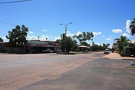
Quilpie (/ˈkwɪlpi/ KWIL-pee) is a town and a locality situated in the Channel Country of South West Queensland, Australia. The town is the administrative centre of the Quilpie Shire local government area. In the 2011 census, Quilpie had a population of 574 people.
Contents
- Map of Quilpie QLD 4480 Australia
- Geography
- History
- Economy
- Flora and fauna
- Facilities and services
- Education
- Climate
- Events
- Notable people from Quilpie
- References
Map of Quilpie QLD 4480, Australia
The economy of the area is based on the grazing and mining industries. The area has one of the largest deposits of boulder opal in the world, and also has extensive deposits of gas and oil.
Geography
Situated on the banks of the Bulloo River and on the Diamantina Developmental Road, it is 208 kilometres (129 mi) west of Charleville, and 980 kilometres (610 mi) west of the state capital, Brisbane. Quilpie is the administrative centre of the Quilpie Shire, which at the 2006 census had a population of 986. Other townships in the shire include Adavale and Eromanga.
In the 2006 census, Quilpie had a population of 560, a decline from the 2001 census population of 645. Around 14% of the population of Quilpie identity as Aboriginal or Torres Strait Islander and around 1% were born outside Australia.
History
Quilpie was gazetted as a town in 1917 owing to the railway that was laid down from Brisbane. The town is believed to lie on the border of the Bunthamurra and Mardgany Indigenous Australian tribal areas.
The local government centre was previously Adavale within Adavale Shire, but this was moved to Quilpie with the availability of rail transport and the name change to Quilpie Shire. It takes its name from the Indigenous Australian word for stone curlew, quilpeta. The first post office was opened in 1921. Two years later the telephone reached Quilpie and in 1927 the first court house in the town was established.
A fire destroyed a block of the main street in 1926. With no town water the residents watched helplessly. A bore was sunk into the Great Artesian Basin in 1933. It provided drinking water for the town and for a period between 1952 and 1963 the hot water was used to generate electricity for the town.
At the 2006 census, Quilpie had a population of 560.
Economy
The area is wholly devoted to grazing. Boulder opal, oil and gas mining are major secondary industries for the local economy. The majority of the employees of these industries are local residents, with low rates of both unemployment and itinerant work.
Flora and fauna
The most common species of trees in the district are:
There are a large range of animals (including reptiles and insects) that are can be found in the area including:
Facilities and services
Quilpie residents enjoy free access to many amenities including the town library, swimming pool, golf course, museum, sports grounds, an air-conditioned hall and supper room etc. There are well stocked stores and plenty of attractions for visitors with displays of opals and the works of local artists and as well as an information centre. The Brick Hotel has been restored to house displays of opal and art and provide a community learning space.
Education
Quilpie State School was founded in 1918. It is now known as Quilpie State College. The school began offering secondary education in 1966 and now operates as a P-10 school. The Josephite sisters founded St. Finbarr's primary school in the 1950, although it is now under lay administration. It was the last rural Catholic primary boarding school in Queensland when boarding facilities closed in 2008. Eromanga State School currently operates in the township of Eromanga approximately 90km west of Quilpie. It has had a chequered history when it was open in the following years - 1897-1908, 1910-1911, 1917-1936, 1967-1981, 1990-present.
Many other public schools have operated in the Quilpie district. The Milo Provisional School was functional between 1888 and 1906. Adavale State School had a long history from 1888-1968. Cheepie State School opened in 1915 and closed in 1974. The Toompine Provisional School was open between 1900 and 1902, for a time operating as a half-time school with Duck Creek State School which was open between 1901 and 1905. The Goombie State School operated between 1875 and 1977.
Climate
Quilpie has a semi-arid climate with hot summers and mild, spring-like winters.