
PIN 360410 Elevation 73 m Area code +912824 | Time zone IST (UTC+5:30) Telephone code +912824 Population 84,545 (2014) Local time Tuesday 12:18 AM | |
 | ||
Weather 24°C, Wind W at 6 km/h, 32% Humidity Neighborhoods Radha Nagar, Vishi Plot, Shastri Nagar, Janseva Society, Chistiya Colony | ||
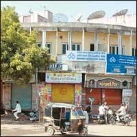
Dhoraji ( pronunciation ) is a city situated on the banks of the river Safura, a tributary of the river Bhadar. It a municipality in the Rajkot district in the state of Gujarat, India.
Contents
- Map of Dhoraji Gujarat 360410
- History
- Temples
- Ghar Ni Dhoraji Fort
- Demographics
- Air
- Road
- Railway
- Environmental Issues
- Major Business
- References
Map of Dhoraji, Gujarat 360410
History
Dhoraji was acquired by Kumbhaji II of Gondal State from Junagadh State about the middle of the eighteenth century. Sir Bhagwatsinhji, the noble ruler of Gondal State, was born at Dhoraji Darbargadh. He established a town planning department and in the late 19th century, introduced town planning principals to regularize and monitor the growth of the fortified town of Gondal, Dhoraji and Upleta and Patanvav.
With the arrival of railways, a new part of the Dhoraji town, between the railway station and the old town, was designed using axial planning, having broad avenues, road junctions, parks, bazaars and public buildings. It is a good. example of urban planning of an Indian town during British Raj.
Temples
Rushiwadi Bileshwar Mahadev Temple, Since 1959, Ling Meet In, Bill Tree,
Shri Chetaniya Hanuman, Since 1965, Janmashtami Mela Ground, Near Vegetable Market,
Shri Panchnath Mahadev, Since 1820, Jamnagar Highway, Dhoraji.
Shree Swaminarayan Mandir is also a very popular spiritual centre in the town
Murli Manohar Temple, Supedi - Supedi is a village located near Dharoji in the district of Rajkot in the Indian state of Gujarat. Murli Manohar Temple here is a beautiful temple older than 350 years, bearing various architectural styles like Gujarati ornamental, Rajasthani and Indo-mughal styles.
Ghar Ni Dhoraji Fort
The fortification of Dhoraji was completed in 1755 AD. The massive fort wall has several bastions, 4 main gates and 3 smaller gates, known as baris. The four main gates are Kathiawadi Darwaja in the East, Porbandar Gate in the West, Halar Gate in the North and Junagadh Gate in the South. The smaller gates are- Darbari Bari, Bhimji Bari and Sati Bari. Darbargadh in Dhoraji is located at the highest point in the town and is approached by Darbari Bari; a beautiful gate adorned with jharokha, resting on brackets of 4 elephant statues in different poses. A finely carved entrance gate leads to Darbargadh in the middle of a courtyard. Darbargadh is a three a multi-storey structure on a high plinth. The facade is ornamented with sculptures of musicians, complex geometric pattern, images of lions in different postures on long caves, profusely carved pillars, horizontal friezes, decorative kanguras and windows framing the skyline. It is designed like a jewel box - in the same architectural style of Navlakha Places at Gondal.
Situated next to Darbargadh is the exceptionally elegant building of Pani No Kotho. The beautifully structured balconies on all the four sides make the building give an impression of a palace building. In reality, it houses a pumping station and a water tank. It is a perfect specimen of blending utilities and aesthetics to create a delightful architecture
Located on the left of Darbargadh is the temple of Goddess Ashapura. Though at present the royal temple needs restoration, but it is still magnificent enough to attract tourist’s interest.
A further walk from the temple leads the tourists to some of the most beautiful houses of rich and prosperous Memon merchants.
Demographics
As of 2001 India census, Dhoraji had a population of 80,807. Males constitute 51% of the population and females 49%. Dhoraji has an average literacy rate of 71%, higher than the national average of 59.5%: male literacy is 78% and, female literacy is 65%. In Dhoraji, 11% of the population is under 6 years of age. Major population ratio is of Memons[Muslim], Patels[Hindu] at dhoraji.
Air
Rajkot and Porbandar are the nearest airports. Kesod and Jamnagar are also nearby airports.
Road
Dhoraji is on National Highway 8B. It connects Dhoraji with Upleta, Rajkot, Porbandar, Jamnagar, Gondal and Jetpur. State transport corporation and private bus operators provide bus services.
Railway
Dhoraji railway station lies on the Wansjaliya-Jetalsar railway line that connects with Rajkot, the nearest large city. Wansjaliya railway junction is west of Dhoraji and connects with Porbandar, Jamnagar. Dhoraji railway station and Jetalsar railway junction are east of Dhoraji and connect with Rajkot. The railway line is broad gauge.