
Country United States County Rockingham Time zone Eastern (UTC-5) Elevation 86 m Population 33,109 (2010) | State New Hampshire Incorporated 1827 Area code(s) 603 Zip code 03038 Local time Tuesday 12:31 AM | |
 | ||
Weather -1°C, Wind SE at 6 km/h, 43% Humidity | ||
Derry is a town in Rockingham County, New Hampshire, United States. The population was 33,109 at the 2010 census. Although it is a town and not a city, Derry is the fourth most-populous community in the state. The town's nickname, "Spacetown", derives from the fact that Derry is the birthplace of Alan Shepard, the first astronaut from the United States in space. Derry was also for a time the home of the poet Robert Frost and his family.
Contents
- Map of Derry NH 03038 USA
- 18 21 weston st derry new hampshire waterfront homes
- History
- Geography
- Demographics
- Town center
- Top employers
- Public schools
- Private schools
- Media
- Notable people
- Sites of interest
- References
Map of Derry, NH 03038, USA
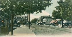
The primary settlement in town, where 22,015 people resided at the 2010 census, is defined by the U.S. Census Bureau as the Derry census-designated place (CDP) and includes the densely populated portions of the town centered on the intersection of New Hampshire Route 28 and New Hampshire Route 102.
18 21 weston st derry new hampshire waterfront homes
History
Although it was first settled by Scots-Irish families in 1719, Derry was not incorporated until 1827. It was originally a part of Londonderry, as was Windham and portions of Manchester, Salem and Hudson. The town was named after the city of Derry in Ireland, the Irish word "Doire" meaning "oak woods." The first potato planted in the United States was planted here in 1719. The town is the location of two of America's oldest private schools, Pinkerton Academy, founded in 1814 and still in operation, and the closed Adams Female Seminary.
Derry was once a linen and leather-making center until New England textile industries moved south in the 20th century. As recently as World War II, Derry was also a sleepy farming community. From 1900 to 1911, poet Robert Frost lived with his family on a farm in Derry purchased for him by his grandfather. The Robert Frost Farm is now a National Historic Landmark and state park and is open to the public for tours, poetry readings and other cultural events from spring through fall.
The post-war suburban boom, the town's proximity to Boston in the south and Manchester to the northwest, and the construction of Interstate 93 through town led to a huge population boom. Although this growth has slowed somewhat, the population of Derry still increased by 15 percent during the 1990s.
The Manchester and Lawrence branch of the B&M ran through Derry, but is now abandoned. The New Hampshire Department of Transportation stated in its I-93 corridor transit study and its 2012 statewide rail plan that it could be feasible to reopen the line.
Geography
According to the United States Census Bureau, the town has a total area of 36.5 square miles (94.5 km2), of which 35.6 square miles (92.2 km2) is land and 0.9 square miles (2.3 km2) is water, comprising 2.39% of the town. Derry is drained by Beaver Brook. The highest point in the town is Warner Hill, at 605 feet (184 m) above sea level, where from the top one can see the Boston skyline on a clear day. Derry lies almost fully within the Merrimack River watershed, with a small section along the northern border of town lying in the Piscataqua River watershed.
The urban part of the town, defined as a census-designated place (CDP), is located near the western border of the town and covers an area of 15.7 square miles (41 km2), about 42.8% of the area of the town. 15.4 sq mi (40 km2) of the CDP is land, and 0.2 sq mi (0.52 km2) of it is water, about 1.60% of the total area of the CDP. The village of East Derry is located approximately 2 miles (3 km) east of the CDP and close to the geographic center of the town.
Derry is crossed by Interstate 93 and New Hampshire routes 28 and 102.
Demographics
As of the census of 2010, there were 33,109 people, 12,537 households, and 8,767 families residing in the town. The population density was 924.8 people per square mile (357.2/km²). There were 13,277 housing units at an average density of 143.2/km² (370.9/sq mi). The racial makeup of the town was 94.5% White, 1.0% African American, 0.2% American Indian and Alaska Native, 1.5% Asian, 0.0% Pacific Islander, 0.9% some other race, and 1.7% from two or more races. 3.3% of the population were Hispanic or Latino of any race.
There were 12,537 households, out of which 35.0% had children under the age of 18 living with them, 52.4% had a married couple living together, 12.2% had a woman whose husband does not live with her, and 30.1% were non-families. 23.0% of all households were made up of individuals and 6.4% had someone living alone who was 65 years of age or older. The average household size was 2.62, and the average family size was 3.10.
In the town, the population was spread out with 24.7% under the age of 18, 9.3% from 18 to 24, 27.0% from 25 to 44, 30.4% from 45 to 64, and 8.7% who were 65 years of age or older. The median age was 38.2 years. For every 100 females there were 98.6 males. For every 100 females age 18 and over, there were 95.9 males.
At the 2000 census the median income for a household in the town was $54,634, and the median income for a family was $61,625. Males had a median income of $41,271 versus $30,108 for females. The per capita income for the town was $22,315. 4.6% of the population and 3.3% of families were below the poverty line. Out of the total people living in poverty, 5.0% were under the age of 18 and 7.1% were 65 or older.
Town center
As of the census of 2010, there were 22,015 people, 8,806 households, and 5,704 families residing in the CDP (census-designated place), the urban center of Derry. The population density was 1,429.5 people per square mile (550.4/km²). There were 9,339 housing units at an average density of 233.5/km² (606.4/sq mi). The racial makeup of the town center was 94.2% White, 1.0% African American, 0.3% American Indian or Alaska Native, 1.6% Asian, 0.0% Pacific Islander, 1.1% some other race, and 1.8% from two or more races. 3.6% of the population were Hispanic or Latino of any race.
There were 8,806 households, out of which 32.8% had children under the age of 18 living with them, 45.6% had a married couple living together, 13.5% had a woman whose husband does not live with her, and 35.2% were non-families. 27.3% of all households were made up of individuals, and 7.6% had someone living alone who was 65 years of age or older. The average household size was 2.48 and the average family size was 3.03.
In the CDP, the population was spread out with 23.6% under the age of 18, 9.8% from 18 to 24, 28.2% from 25 to 44, 28.9% from 45 to 64, and 9.6% who were 65 years of age or older. The median age was 37.5 years. For every 100 females there were 98.6 males. For every 100 females age 18 and over, there were 94.1 males.
At the 2000 census the median income for a household was $49,792, and the median income for a family was $56,332. Males had a median income of $40,185 versus $28,580 for females. The per capita income for the town was $21,938. 6.0% of the population and 4.3% of families were below the poverty line. Out of the total people living in poverty, 6.9% were under the age of 18 and 7.6% were 65 or older.
Top employers
According to the Town's 2012 Comprehensive Annual Financial Report, the top employers in the town are:
Public schools
Private schools
Media
Derry is home to three media sources, the weekly Derry News, which is owned by The Eagle-Tribune, the weekly Nutfield News, which is locally owned by Nutfield Publishing, and independently owned television station WBIN-TV. Derry is located within the Boston broadcast media market. Derry Community Television is the town's Public-access television station on local cable TV.