
Country United States County Rockingham Elevation 420 ft (128 m) Zip code 03053 Local time Sunday 9:36 AM | State New Hampshire Incorporated 1722 Time zone Eastern (UTC-5) Population 24,129 (2010) | |
 | ||
Weather -13°C, Wind W at 27 km/h, 34% Humidity Points of interest Moonlight Meadery LLC, Aviation Museum of New Hampshire, Londonderry Sewage Lagoon | ||
26 woodbine drive londonderry new hampshire real estate homes
Londonderry is a town in western Rockingham County, New Hampshire, United States. The town is bordered on the north by the city of Manchester and on the east by the town of Derry. The population was 24,129 at the 2010 census. Londonderry is known for its apple orchards and is home to the headquarters of Stonyfield Farm and partial home to Manchester-Boston Regional Airport.
Contents
- 26 woodbine drive londonderry new hampshire real estate homes
- Map of Londonderry NH USA
- History
- Geography
- Demographics
- Census designated place
- Economy
- Education
- Notable people
- References
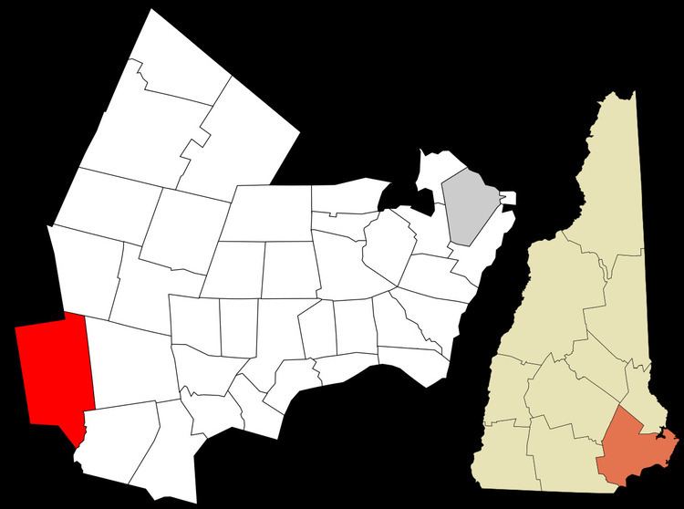
Map of Londonderry, NH, USA
The more densely settled portion of town, where 11,037 people resided at the 2010 census, is defined as the Londonderry census-designated place (CDP) and roughly occupies the southeastern and southern parts of town, around New Hampshire Route 102.
History
Londonderry lies in an area that was first known as "Nutfield" because of the dense woods with nut trees. The town was settled in 1718 by Scots-Irish settlers, many of whom had left their homes in Londonderry in the Province of Ulster in the north of Ireland, and arrived in Boston in 1718 to start a new life without religious wars and persecution. In 1722, the town was chartered and given the name "Londonderry".
Early Ulster Scots settlers spread out into surrounding villages, bringing Irish and Scottish names like Antrim, Derry and Dunbarton. Londonderry was the second largest town in early colonial times, and Derry, Windham and a portion of Manchester were formed from it.
In 1719, the first American potato was grown in Derry, then a part of Londonderry.
The first U.S. census, conducted in 1790, reported the town's population to be 2,622.
Geography
Londonderry is located in southwestern Rockingham County, between Manchester to the north, Derry to the east, and Hudson to the south. The western, northern, and southern borders of the town are with Hillsborough County. According to the United States Census Bureau, the town has a total area of 42.1 square miles (109.1 km2), of which 42.0 square miles (108.7 km2) is land and 0.1 square miles (0.3 km2) is water, comprising 0.31% of the town.
The census-designated place portion of Londonderry is bordered by the Derry town line to the east, the Windham line to the southeast, and the Hudson line to the southwest. The northwestern border of the CDP zigzags, following New Hampshire Route 102 (Nashua Road) from the Hudson town line to New Hampshire Route 128, then NH 128 (Mammoth Road) north to Litchfield Road, then Stonehenge Road east to Interstate 93, then I-93 south to Ash Street, which leads east to the Derry line. The CDP includes the Londonderry town offices (east side of Mammoth Road) but not the Londonderry High School and Middle School complexes (west side of Mammoth Road). The CDP has a total area of 12.33 square miles (31.94 km2), of which 0.02 square miles (0.06 km2), or 0.19%, is water.
The town of Londonderry is drained on the east by Beaver Brook and on the west by Little Cohas Brook and Nesenkeag Brook, all of which flow to the Merrimack River. The town's highest point is 535 feet (163 m) above sea level, on "Number Eight Hill" (named after the old school house that used to be on it) north of the center of town.
The town is crossed by Interstate 93, New Hampshire Route 102, New Hampshire Route 128, and New Hampshire Route 28. Half of Manchester–Boston Regional Airport, including the main terminal, is in the northwest corner of the town.
Demographics
As of the census of 2010, there were 24,129 people, 8,438 households, and 6,678 families residing in the town. The population density was 574.5 people per square mile (221.9/km²). There were 8,771 housing units at an average density of 208.8 per square mile (80.7/km²). The racial makeup of the town was 95.8% White, 0.7% Black or African American, 0.1% Native American or Alaska Native, 1.7% Asian, 0.03% Pacific Islander, 0.4% some other race, and 1.2% from two or more races. Hispanic or Latino of any race were 2.1% of the population.
There were 8,438 households, out of which 41.7% had children under the age of 18 living with them, 65.9% were headed by married couples living together, 9.2% had a female householder with no husband present, and 20.9% were non-families. 15.8% of all households were made up of individuals, and 5.1% were someone living alone who was 65 years of age or older. The average household size was 2.86, and the average family size was 3.21.
In the town, the population was spread out with 26.9% under the age of 18, 7.1% from 18 to 24, 23.6% from 25 to 44, 33.6% from 45 to 64, and 8.7% who were 65 years of age or older. The median age was 39.6 years. For every 100 females there were 98.3 males. For every 100 females age 18 and over, there were 94.7 males.
For the period 2009-13, the estimated median annual income for a household in the town was $90,263, and the median income for a family was $107,100. Male full-time workers had a median income of $71,280 versus $50,081 for females. The per capita income for the town was $38,553. About 1.6% of families and 2.8% of the population were below the poverty line, including 2.6% of those under age 18 and 4.7% of those age 65 or over.
Census-designated place
As of the census of 2010, there were 11,037 people, 3,958 households, and 3,098 families residing in the CDP occupying the southeastern and southern parts of town. The population density was 896.8 people per square mile (346.3/km²). There were 4,105 housing units at an average density of 333.6 per square mile (128.8/km²). The racial makeup of the CDP was 95.8% White, 0.8% Black or African American, 0.1% Native American or Alaska Native, 1.5% Asian, 0.03% Pacific Islander, 0.5% some other race, and 1.4% from two or more races. Hispanic or Latino of any race were 2.5% of the population.
There were 3,958 households, out of which 39.9% had children under the age of 18 living with them, 62.8% were headed by married couples living together, 11.0% had a female householder with no husband present, and 21.7% were non-families. 16.4% of all households were made up of individuals, and 5.5% were someone living alone who was 65 years of age or older. The average household size was 2.79 and the average family size was 3.13.
In the CDP, the population was spread out with 25.6% under the age of 18, 7.6% from 18 to 24, 22.9% from 25 to 44, 33.6% from 45 to 64, and 10.3% who were 65 years of age or older. The median age was 41.3 years. For every 100 females there were 96.2 males. For every 100 females age 18 and over, there were 93.0 males.
For the period 2009-2013, the estimated median annual income for a household in the CDP was $88,487, and the median income for a family was $101,858. Male full-time workers had a median income of $76,743 versus $47,617 for females. The per capita income for the CDP was $37,970. About 2.1% of families and 3.3% of the population were below the poverty line, including 3.6% of those under age 18 and 4.3% of those age 65 or over.
Economy
Londonderry is home to numerous businesses, many of which are located in the northern part of the town near Manchester-Boston Regional Airport (MHT), or in the southeastern part of town near I-93, on NH 102. Major businesses headquartered in town include Stonyfield Farm and Blue Seal Feeds; a bottling facility of the Coca-Cola Bottling Co. is also located in town. The town is also home to numerous chain retailers.
Mack's Apples, Sunnycrest Farm, Elwood Orchards, and Woodmont Orchards are among the several orchards in town and are emblematic of the town's important farming heritage. The abundance of apple orchards in town has made apple picking a popular fall activity among all residents, many of which affectionately refer to the town as "Appletown". However, apple theft is a major issue within the town, and one that the town police are often preoccupied with.
Education
The town is served by the Londonderry School District.
Kindergarten:
Elementary Schools:
Middle School:
High School:
Private Schools: