
Palestine grid 160/156 Website www.deir-nidham.org | ||
 | ||
Name meaning "The monastery of the marshal" Weather 11°C, Wind NE at 8 km/h, 60% Humidity | ||
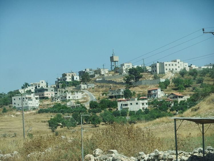
Deir Nidham (Arabic: دير نظام) is a Palestinian village in the Ramallah and al-Bireh Governorate in the central West Bank. It is located approximately 23 kilometers (14 mi) northwest of the city of Ramallah and its elevation is 590 meters (1,940 ft). According to the Palestinian Central Bureau of Statistics (PCBS) 2007 census, the town had a population of 879.
Contents
Map of Dayr Nizam
History
Sherds have been found here from the Byzantine, Crusader/Ayyubid and Mamluk eras.
Ottoman era
In 1517, the village was included in the Ottoman empire with the rest of Palestine and sherds from the early Ottoman era has also been found. In the 1596 tax-records it appeared as Dayr an-Nidam, located in the Nahiya of Jabal Quds of the Liwa of Al-Quds. The population was 4 households, all Muslim. They paid a tax rate of 25% on agricultural products, which included wheat, barley, olive trees, vineyards and fruit trees, goats and beehives in addition to "occasional revenues"; a total of 1200 Akçe.
In 1863 Victor Guérin visited and described it as being half ruined and inhabited only by a hundred fellahins. Several cisterns, partially filled, and a number of antique stones, scattered on the ground or reused, proved to him that it had succeeded a former locality. In 1882, the Palestine Exploration Fund's Survey of Western Palestine (SWP) described it: "A small hamlet on a high point, with olives round it. It is just above the ruins of Tibneh, and water is obtained from the 'Ain Tibneh."
British era
In the 1922 census of Palestine conducted by the British Mandate authorities, Deir Nidham (Dair Inzam) had a population of 106 Muslims. increasing in the 1931 census when Deir Nizam had 166 Muslims in 34 houses.
In 1945 the population was 190, all Muslims, while the total land area was 1,938 dunams, according to an official land and population survey. Of this, 514 were plantations and irrigable land, 483 for cereals, while 31 dunams were classified as built-up areas.
1948-1967
In the wake of the 1948 Arab–Israeli War, and after the 1949 Armistice Agreements, Deir Nidham came under Jordanian rule.
1967-present
After the Six-Day War in 1967, Deir Nidham has been under Israeli occupation. A secondary school exists in Deir Nidham and high school students are educated at a nearby village. Most university students attend Birzeit University or the al-Quds Open University. The electricity network in the village is affiliated with that of Jerusalem, while its water network is managed by the Palestinian National Authority. A village council of seven members was established in 2005 to govern the village.