
County Bates ZIP codes 64720, 64725 Elevation 258 m Local time Sunday 7:46 AM | Time zone CST (UTC-6) GNIS feature ID 0766291 Area 82.12 km² Population 2,162 (2000) | |
 | ||
Weather 13°C, Wind S at 27 km/h, 74% Humidity | ||
Deer Creek Township is one of twenty-four townships in Bates County, Missouri, USA. As of the 2000 census, its population was 2,162.
Contents
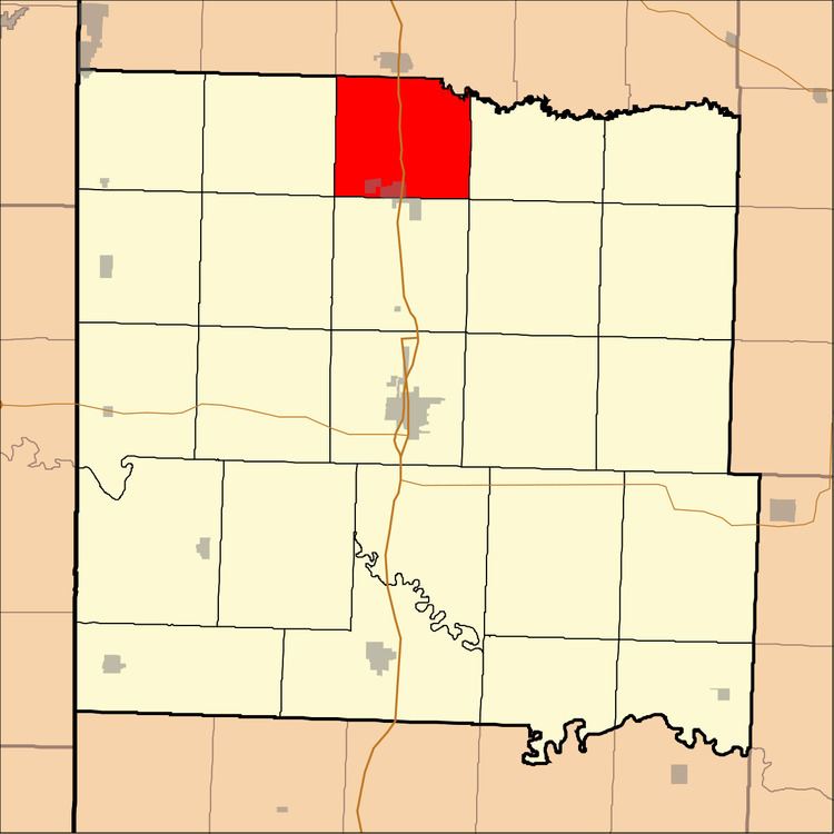
- Map of Deer Creek Township MO USA
- Geography
- Cities towns villages
- Unincorporated towns
- Adjacent townships
- Cemeteries
- Major highways
- Rivers
- School districts
- Political districts
- References
Map of Deer Creek Township, MO, USA
The township was named for a nearby creek of the same name where deer were abundant.
Geography
According to the United States Census Bureau, Deer Creek Township covers an area of 31.71 square miles (82.12 square kilometers); of this, 31.67 square miles (82.03 square kilometers, 99.89 percent) is land and 0.03 square miles (0.08 square kilometers, 0.1 percent) is water.
Cities, towns, villages
Unincorporated towns
(This list is based on USGS data and may include former settlements.)
Adjacent townships
Cemeteries
The township contains Crescent Hill Cemetery.
Major highways
Rivers
School districts
Political districts
References
Deer Creek Township, Bates County, Missouri Wikipedia(Text) CC BY-SA