
Named for Johann, Baron de Kalb Area 942.4 km² Population 42,307 (2013) | Founded 1835 Unemployment rate 3.7% (Apr 2015) | |
 | ||
Points of interest Auburn Cord Duesenb, National Automotive & Truck, Country Heritage Winery, Early Ford V‑8 Foundati, National Military History C | ||
DeKalb County is a county located in the U.S. state of Indiana. As of 2010, the population was 42,223. The county seat is Auburn. Named for Revolutionary War hero Johann, Baron de Kalb (1721–1780), the county was created by the Indiana legislature in 1835 and organized in 1837.
Contents
- Map of DeKalb County IN USA
- History
- Geography
- Cities and towns
- Unincorporated communities
- Townships
- Major highways
- Adjacent counties
- Climate and weather
- Government
- Demographics
- School districts
- Private schools
- References
Map of DeKalb County, IN, USA
History
DeKalb County was formed in 1837. It was named for the heroic General Johann de Kalb, a Continental Army officer from Bavaria, who was fatally wounded at the Battle of Camden, South Carolina. The original settlers to arrive in DeKalb County were migrants from New England who were settling the wilderness of what was then known as the Northwest Territory. These people were "Yankee" migrants, that is to say they were descended from the English Puritans who settled New England in the colonial era. In the 1870s immigrants from Ireland and Germany began arriving in DeKalb County, in large numbers.
Geography
According to the 2010 census, the county has a total area of 363.85 square miles (942.4 km2), of which 362.82 square miles (939.7 km2) (or 99.72%) is land and 1.03 square miles (2.7 km2) (or 0.28%) is water.
Cities and towns
Unincorporated communities
Townships
Major highways
Adjacent counties
Climate and weather
In recent years, average temperatures in Auburn have ranged from a low of 17 °F (−8 °C) in January to a high of 84 °F (29 °C) in July, although a record low of −24 °F (−31 °C) was recorded in January 1984 and a record high of 106 °F (41 °C) was recorded in June 1988. Average monthly precipitation ranged from 1.42 inches (36 mm) in February to 4.17 inches (106 mm) in June.
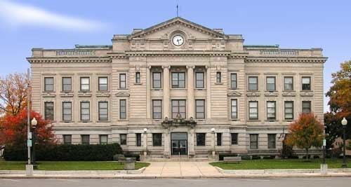
Government
The county government is a constitutional body, and is granted specific powers by the Constitution of Indiana, and by the Indiana Code.
County Council: The county council is the fiscal branch of the county government and controls all the spending and revenue collection in the county. Representatives are elected from county districts. The council members serve four year terms. They are responsible for setting salaries, the annual budget, and special spending. The council also has limited authority to impose local taxes, in the form of an income and property tax that is subject to state level approval, excise taxes, and service taxes.
Board of Commissioners: A three-member board of commissioners combines executive and non-fiscal legislative powers. Commissioners are elected county-wide, in staggered four-year terms. One commissioner serves as president. The commissioners also function as the county drainage board, exercising control over the construction and maintenance of legal drains.
Courts: DeKalb County has a Circuit Court (75th Judicial Circuit) and two Superior Courts. By local rule, approved by the Indiana Supreme Court, the jurisdiction of the Circuit Court is currently limited to juvenile and domestic cases. Criminal, civil and domestic cases are heard in the two superior courts. Judges of each court are elected for six-year terms on partisan tickets.
County Officials: The county has several other elected offices, including sheriff, coroner, auditor, treasurer, recorder, surveyor, and circuit court clerk. Each of these elected officers serves a term of four years and oversees a different part of county government. Members elected to county government positions are required to declare a party affiliation and to be residents of the county.
DeKalb County is part of Indiana's 3rd congressional district and in 2008 was represented by Mark Souder in the United States Congress. It is also part of Indiana Senate districts 13 and 14, and Indiana House of Representatives districts 51, 52 and 85.
Demographics
As of the 2010 United States Census, there were 42,223 people, 15,951 households, and 11,328 families residing in the county. The population density was 116.4 inhabitants per square mile (44.9/km2). There were 17,558 housing units at an average density of 48.4 per square mile (18.7/km2). The racial makeup of the county was 96.9% white, 0.5% Asian, 0.4% black or African American, 0.2% American Indian, 0.8% from other races, and 1.2% from two or more races. Those of Hispanic or Latino origin made up 2.4% of the population. In terms of ancestry, 36.3% were German, 10.9% were American, 10.8% were Irish, and 9.1% were English.
Of the 15,951 households, 35.2% had children under the age of 18 living with them, 54.8% were married couples living together, 10.5% had a female householder with no husband present, 29.0% were non-families, and 24.3% of all households were made up of individuals. The average household size was 2.61 and the average family size was 3.08. The median age was 38.1 years.
The median income for a household in the county was $47,697 and the median income for a family was $55,280. Males had a median income of $44,880 versus $30,663 for females. The per capita income for the county was $21,779. About 6.7% of families and 9.0% of the population were below the poverty line, including 11.3% of those under age 18 and 6.2% of those age 65 or over.