
Country United States County Yolo Incorporated March 28, 1917 Elevation 16 m Population 66,205 (2013) | State California Rail depot 1868 Local time Saturday 4:41 AM | |
 | ||
Weather 9°C, Wind S at 11 km/h, 88% Humidity Colleges and Universities University of California, Davis, D–Q University | ||
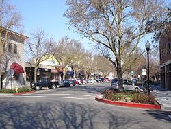
Minute tour of davis california
Davis is a city in the U.S. state of California and the most populous city in Yolo County. It had a population of 65,622 in 2010, not including the on-campus population of the University of California, Davis, which was 32,153 in 2009.
Contents
- Minute tour of davis california
- Map of Davis CA USA
- History
- Location
- Climate
- Neighborhoods
- Environment
- Demographics
- 2010
- 2000
- Economy
- Top employers
- Davis Dollars
- Bicycling
- Whole Earth Festival
- Celebrate Davis
- Picnic Day
- Davis Transmedia Art Walk
- Mondavi Center
- UC Davis Arboretum
- The Domes
- Farmers Market
- Media
- Toad Tunnel
- University of California
- D Q University
- Other colleges
- Public schools
- Private schools
- Notable natives and residents
- Sister cities
- References
Map of Davis, CA, USA
History
Davis grew into a Southern Pacific Railroad depot built in 1868. It was then known as "Davisville", named after Jerome C. Davis, a prominent local farmer. However, the post office at Davisville shortened the town name simply to "Davis" in 1907. The name stuck, and the city of Davis was incorporated on March 28, 1917.
From its inception as a farming community, Davis has been known for its contributions to agricultural policy along with veterinary care and animal husbandry. Following the passage of the University Farm Bill in 1905 by the California State Legislature, Governor George Pardee selected Davis out of 50 other sites as the future home to the University of California's University Farm, officially opening to students in 1908. The farm, later renamed the Northern Branch of the College of Agriculture in 1922, was upgraded into the seventh UC general campus, the University of California, Davis, in 1959.
Location
Davis is located in Yolo County, California, 11 mi (18 km) west of Sacramento, 70 mi (113 km) northeast of San Francisco, 385 mi (619 km) north of Los Angeles, at the intersection of Interstate 80 and State Route 113. Neighboring towns include Dixon, Winters, and Woodland.
Davis lies in the Sacramento Valley, the northern portion of the Central San Joaquin Valley, in Northern California, at an elevation of about 16 m (52 ft) above sea level.
According to the United States Census Bureau, the city has a total area of 10.5 square miles (27 km2). 10.4 square miles (27 km2) of it is land and 0.04 square miles (0.10 km2) of it (0.19%) is water.
The topography is flat, which has helped Davis to become known as a haven for bicyclists.
Climate
The Davis climate resembles that of nearby Sacramento and is typical of California's Central Valley Mediterranean climate regime: dry, hot summers and cool, rainy, winters. It is classified as a Köppen Csa climate. Average temperatures range from 46 °F (8 °C) in December and January to 75 °F (24 °C) in July and August. Thick ground fog called tule fog settles into Davis during late fall and winter. This fog can be dense with visibility to nearly zero. As in other areas of northern California, the tule fog is a leading cause of road accidents in the winter season.
Record temperatures range from a high of 116 °F (47 °C) on July 17, 1925, to a low of 12 °F (−11 °C) on December 11, 1932.
Neighborhoods
Davis is internally divided by two freeways (Interstate 80 and State Route 113), a north–south railroad (California Northern), an east-west mainline (Union Pacific) and several major streets. The city is unofficially divided into six main districts made up of smaller neighborhoods (often originally named as housing subdivisions):
The University of California, Davis is located south of Russell Boulevard and west of A Street and then south of 1st Street. The land occupied by the university is not incorporated within the boundaries of the city of Davis and lies within both Yolo and Solano Counties.
Environment
Local energy planning began in Davis after the energy crisis of 1973. A new building code promoted energy efficiency. Energy use in buildings decreased dramatically and in 1981 Davis citizens won a $100, 000 prize from utility PG&E, for cutting electricity use during the summer peak.
On November 14, 1984, the Davis City Council declared the city to be a nuclear-free zone. In 1998, the City passed a 'Dark Skies' ordinance in an effort to reduce light pollution in the night sky.
Demographics
Davis is part of the Sacramento–Arden-Arcade–Roseville Metropolitan Statistical Area.
2010
The 2010 United States Census reported that Davis had a population of 65,622. The population density was 6,615.8 people per square mile (2,554.4/km²). The racial makeup of Davis was 42,571 (64.9%) White, 1,528 (2.3%) African American, 339 (0.5%) Native American, 14,355 (21.9%) Asian, 136 (0.2%) Pacific Islander, 3,121 (4.8%) from other races, and 3,572 (5.4%) from two or more races. Hispanic or Latino of any race were 8,172 persons (12.5%).
In 2006, Davis was ranked as the second most educated city (in terms of the percentage of residents with graduate degrees) in the US by CNN Money Magazine, after Arlington, Virginia.
Davis' Asian population of 14,355 was apportioned among 1,631 Indian Americans, 6,395 Chinese Americans, 1,560 Korean Americans, 1,185 Vietnamese Americans, 1,033 Filipino Americans, 953 Japanese Americans, and 1,598 other Asian Americans.
Davis' Hispanic and Latino population of 8,172 was apportioned among 5,618 Mexican American, 221 Puerto Rican American, 80 Cuban American, and 2,253 other Hispanic and Latino.
The Census reported that 63,522 people (96.8% of the population) lived in households, 1,823 (2.8%) lived in non-institutionalized group quarters, and 277 (0.4%) were institutionalized.
There were 24,873 households, of which 6,119 (24.6%) had children under the age of 18 living in them, 9,343 (37.6%) were opposite-sex married couples living together, 1,880 (7.6%) had a female householder with no husband present, and 702 (2.8%) had a male householder with no wife present. There were 1,295 (5.2%) unmarried opposite-sex partnerships, and 210 (0.8%) same-sex married couples or partnerships. 5,952 households (23.9%) were made up of individuals and 1,665 (6.7%) had someone living alone who was 65 years of age or older. The average household size was 2.55. There were 11,925 families (47.9% of all households); the average family size was 2.97.
The population age and sex distribution was 10,760 people (16.4%) under the age of 18, 21,757 people (33.2%) aged 18 to 24, 14,823 people (22.6%) aged 25 to 44, 12,685 people (19.3%) aged 45 to 64, and 5,597 people (8.5%) who were 65 years of age or older. The median age was 25.2 years. For every 100 females there were 90.5 males. For every 100 females age 18 and over, there were 88.0 males.
There were 25,869 housing units with an average density of 2,608.0 per square mile (1,007.0/km²), of which 10,699 (43.0%) were owner-occupied, and 14,174 (57.0%) were occupied by renters. The homeowner vacancy rate was 0.9%; the rental vacancy rate was 3.5%. 27,594 people (42.0% of the population) lived in owner-occupied housing units and 35,928 people (54.7%) lived in rental housing units.
2000
As of the United States 2000 Census, there were 60,308 people, 22,948 households, and 11,290 families residing in the city. The population density was 5,769.2 inhabitants per square mile (2,228.2/km2). There were 23,617 housing units at an average density of 2,259.3 per square mile (872.6/km2). The racial composition of the city was 70.07% White, 2.35% Black or African American, 0.67% Native American, 17.5% Asian, 0.24% Pacific Islander, 4.26% from other races, and 4.87% from two or more races. 9.61% of the population were Hispanic or Latino of any race.
There were 22,948 households of which 26.4% had children under the age of 18 living with them, 38.3% were married couples living together, 8.2% had a female householder with no husband present, and 50.8% were non-families. 25.0% of all households were composed of individuals and 5.2% had someone living alone who was 65 years of age or older. The average household size was 2.50 and the average family size was 3.00.
In the city, the population age distribution was 18.6% under the age of 18, 30.9% from 18 to 24, 27.1% from 25 to 44, 16.7% from 45 to 64, and 6.6% who were 65 years of age or older. The median age was 25 years. For every 100 females there were 91.2 males. For every 100 females age 18 and over, there were 87.8 males.
The median income for a household in the city was $42,454, and the median income for a family was $74,051. Males had a median income of $51,189 versus $36,082 for females. The per capita income for the city was $22,937. About 5.4% of families and 24.5% of the population were below the poverty line, including 6.8% of those under age 18 and 2.8% of those age 65 or over.
This city of approximately 62,000 people abuts a university campus of 32,000 students. Although the university's land is not incorporated within the city, many students live off-campus in the city.
Economy
The California Northern Railroad is based in Davis.
Top employers
According to the City's 2011 Comprehensive Annual Financial Report, the top employers in the city are:
Davis Dollars
A community currency scheme is in use in Davis, called Davis Dollars.
Bicycling
Bicycling has been a popular mode of transportation in Davis for decades, particularly among school year children and UC Davis students. In 2010, Davis became the new home of the United States Bicycling Hall of Fame.
Bicycle infrastructure became a political issue in the 1960s, culminating in the election of a pro-bicycle majority to the City Council in 1966. By the early 1970s, Davis became a pioneer in the implementation of cycling facilities. As the city expands, new facilities are usually mandated. As a result, Davis residents today enjoy an extensive network of bike lanes, bike paths, and grade-separated bicycle crossings. The flat terrain and temperate climate are also conducive to bicycling.
In 2005 the Bicycle-Friendly Community program of the League of American Bicyclists recognized Davis as the first Platinum Level city in the US In March 2006, Bicycling Magazine named Davis the best small town for cycling in its compilation of "America's Best Biking Cities." Bicycling appears to be declining among Davis residents: from 1990 to 2000, the US Census Bureau reported a decline in the fraction of commuters traveling by bicycle, from 22 percent to 15 percent. This resulted in the reestablishment of the city's Bicycle Advisory Commission and creation of advocate groups such as "Davis Bicycles!".
In 1996, 2001, 2006, and 2009 the UC Davis "Cal Aggie Cycling" Team won the national road cycling competition. The team also competes off-road and on the track, and has competed in the national competitions of these disciplines. In 2007, UC Davis also organized a record breaking bicycle parade numbering 822 bicycles.
Whole Earth Festival
A continuous stream of bands, speakers and various workshops occurs throughout Mother's Day weekend on each of Whole Earth Festival's (WEF) three stages and other specialty areas. The WEF is organized entirely by UC Davis students, in association with the Associated Students of UC Davis, the Experimental College, and the university.
Celebrate Davis
Celebrate Davis is the annual free festival held by the Davis Chamber of Commerce. It features booths by Davis businesses, live music, food vendors, live animals, activities like rock climbing and zip-line. It concludes with fireworks after dark. Parking is problematic, so most people ride their bikes and use the free valet parking.
Picnic Day
Picnic Day is an annual event at the University of California, Davis and is always held on the third Saturday in April. It is the largest student-run event in the US. Picnic Day starts off with a parade, which features the UC Davis California Aggie Marching Band-uh!, and runs through campus and around downtown Davis and ends with the Battle of the Bands, which lasts until the last band stops playing (sometimes until 2 am). There are over 150 free events and over 50,000 attend every year. Other highlights include: the Dachshund races, a.k.a. the Doxie Derby, held in the Pavilion; the Davis Rock Challenge, the Chemistry Magic Show, and the sheep dog trials. Many departments have exhibits and demonstrations, such as the Cole Facility, which until recently showed a fistulated cow (a cow that has been fitted with a plastic portal (a "fistula") into its digestive system to observe digestion processes). Its name was "Hole-y Cow".
Davis Transmedia Art Walk
The Davis Transmedia Art Walk is a free, self-guided, public art tour includes 23 public murals, 16 sculptures, and 15 galleries and museums all in downtown Davis and the University of Davis campus. A free Davis Art Walk map serves as a detailed guide to the entire collection. The art pieces are all within walking distance of each other. The walk is a roughly circuitous path that can be completed within an hour or two. Every piece of art on the Art Walk has been embedded with an RFID chip. Using a cellphone that supports this technology, you access multimedia files that relate to each work. You can even leave a comment or "burn your own message" for other visitors to see. Artist hosted tours are held on the weekend by appointment only. To pick up a copy of the Davis Art Walk map, visit the Yolo County Visitors Bureau (132 E St., Suite 200; (530) 2978-1900) or the John Natsoulas Center for the Arts (521 1st St.; (530) 756-3938).
Mondavi Center
The Mondavi Center, located on the UC Davis campus, is one of the biggest non-seasonal attractions to Davis. The Mondavi Center is a theater which hosts many world-class touring acts, including star performers such as Yo-Yo Ma and Cecilia Bartoli, and draws a large audience from Sacramento.
UC Davis Arboretum
The UC Davis Arboretum is an arboretum and botanical garden. Plants from all over the world grow in different sections of the park. There are notable oak and native plant collections and a small redwood grove. A small waterway spans the arboretum along the bed of the old North Fork of Putah Creek. Occasionally herons, kingfishers, and cormorants can be seen around the waterways, as well as the ever-present ducks. Tours of the arboretum led by volunteer naturalists are often held for grade-school children.
The Domes
The Domes, (AKA Baggins End Innovative Housing), is an on-campus cooperative housing community designed by project manager Ron Swenson and future student-residents in 1972. Consisting of 14 polyurethane foam-insulated fiberglass domes and located in the Sustainable Research Area at the western end of Orchard Road, it is governed by its 26 UCD student residents. It is one of the few student co-housing cooperative communities in the USA, and is an early example of the modern-day growing tiny house movement. The community has successfully resisted several threats to its continuation over the years.
Farmers Market
The Davis Farmers Market is held every Wednesday evening and Saturday morning. Participants sell a range of fruits and vegetables, baked goods, dairy and meat products (often from certified organic farms), crafts, and plants and flowers. From April to October, the market hosts Picnic in the Park, with musical events and food sold from restaurant stands. The Davis Farmers Market won first place in the 2009, and second place in the 2010 America's Favorite Farmers Markets held by the American Farmland Trust under the large Farmers market classification.
Media
Davis has one daily newspaper, The Davis Enterprise, founded in 1897. UC Davis also has a weekly newspaper called The California Aggie which covers campus, local and national news. Davis Media Access, a community media center, is the umbrella organization of television station DCTV. There are also numerous commercial stations broadcasting from nearby Sacramento. Davis has two community radio stations: KDVS 90.3 FM, on the University of California campus, and KDRT 95.7 FM, a subsidiary of Davis Media Access and one of the first low-power FM radio stations in the United States. Davis has the world's largest English-language local wiki, DavisWiki.
Toad Tunnel
Davis' Toad Tunnel is a wildlife crossing that was constructed in 1995 and has drawn much attention over the years, including a mention on The Daily Show. Because of the building of an overpass, animal lovers worried about toads being killed by cars commuting from South Davis to North Davis, since the toads hopped from one side of a dirt lot (which the overpass replaced) to the reservoir at the other end. After much controversy, a decision was made to build a toad tunnel, which runs beneath the Pole Line Road overpass which crosses Interstate 80. The project cost $14,000. The tunnel is 21 inches (53 cm) wide and 18 inches (46 cm) high.
The tunnel has created problems of its own. The toads originally refused to use the tunnel and so the tunnel was lit to encourage its use. The toads then died from the heat of the lamps inside the tunnel. Once through the tunnel, the toads also had to contend with birds who grew wise to the toad-producing hole in the ground. The exit to the toad tunnel has been decorated by the Postmaster to resemble a toad town.
University of California
The University of California, Davis, or UC Davis, a campus of the University of California, had a 2015 Fall enrollment of 36,104 students. UC Davis has a dominant influence on the social and cultural life of the town.
D-Q University
Also known as Deganawidah-Quetzalcoatl University and much smaller than UC Davis, D-Q University was a two-year institution located on Road 31 in Yolo County 6.7 miles (11 km) west of State Route 113. This is just west of Davis near the Yolo County Airport. About four miles (6 km) to the west, the Road 31 exit from Interstate 505 is marked with cryptic signage, "DQU." The site is about 100 feet (30 m) above mean sea level (AMSL). NAD83 coordinates for the campus are 38°34′02″N 121°53′12″W
The college closed in 2005. The curriculum was said to include heritage and traditional American Indian ceremonies. The 643 acres (2.60 km2) and 5 buildings were formerly a military reservation according to a National Park Service publication, Five Views. The full name of the school is included here so that readers can accurately identify the topic. According to some tribal members, use of the spelled-out name of the university can be offensive. People who want to be culturally respectful refer to the institution as D-Q University. Tribal members in appropriate circumstances may use the full name.
Other colleges
An off-campus branch of Sacramento City College is located in Davis.
Public schools
Davis' public school system is administrated by the Davis Joint Unified School District.
The city has nine public elementary schools (North Davis, Birch Lane, Pioneer Elementary, Patwin, Cesar Chavez, Robert E. Willett, Marguerite Montgomery, Fred T. Korematsu at Mace Ranch, and Fairfield Elementary (which is outside the city limits but opened in 1866 and is Davis Joint Unified School District's oldest public school)). Davis has one school for independent study (Davis School for Independent Study), three public junior high schools (Ralph Waldo Emerson, Oliver Wendell Holmes, and Frances Harper), one main high school (Davis Senior High School), one alternative high school (Martin Luther King High School), and a small technology-based high school (Leonardo da Vinci High School). Cesar Chavez is a Spanish immersion school, with no English integration until the third grade. The junior high schools contain grades 7 through 9. Due to a decline in the school-age population in Davis, two of the elementary schools in south Davis may have their district boundaries changed, or magnet programs may be moved to equalize enrollment. Valley Oak was closed after the 2007–08 school year, and their campus was granted to Da Vinci High (which had formerly been located in the back of Davis Senior High's campus) and a special-ed preschool.
At one time, Chavez and Willett were incorporated together to provide elementary education K–6 to both English-speaking and Spanish immersion students in West Davis. César Chávez served grades K–3 and was called West Davis Elementary, and Robert E. Willett (named for a long-time teacher at the school, now deceased) served grades 4–6 and was known as West Davis Intermediate. Willett now serves K–6 English-speaking students, and Chavez supports the Spanish immersion program for K–6.
Private schools
Notable natives and residents
These are some notable Davis residents, other than UC Davis faculty who were not previously from Davis.
Sister cities
Davis has eight sister cities