
Elevation 19 m Zip code 95620 Local time Wednesday 5:28 PM | Incorporated March 30, 1878 FIPS code 06-19402 Area 18.37 km² Population 18,963 (2013) Area code 707 | |
 | ||
Weather 19°C, Wind NE at 2 km/h, 59% Humidity | ||
Sweet home dixon california
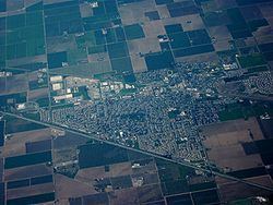
Dixon is a city in northern Solano County, California, United States, located 23 miles (37 km) from the state capital, Sacramento. The population was 18,351 at the 2010 census. Other nearby cities include Vacaville, Winters and Davis.
Contents
- Sweet home dixon california
- Map of Dixon CA 95620 USA
- History
- Geography
- 2010
- 2000
- Guinness World Record Corn Maze
- Notable people
- Transportation
- Top employers
- Radio transmissions
- Schools
- References
Map of Dixon, CA 95620, USA
History
The first semi-permanent European settlement to develop in the (now) Dixon area emerged during the California Gold Rush of the mid-19th century. During this time, the community of Silveyville was founded as a halfway point between the Pacific coast and the rich gold fields of Sacramento—along a route commonly traveled by miners. In 1868, Central Pacific railroad came through the area and missed Silveyville by a few miles. As a result, local leaders decided to physically relocate Silveyville closer to the tracks in order to enjoy the benefits of commerce and travel. One of the first buildings that still stands in Dixon from the 1871 move is the Dixon Methodist Church located at 209 N. Jefferson Street.
Originally, the city was named "Dicksonville" after Thomas Dickson who donated 10 acres of his land for the construction of a railroad depot following the completion of the tracks and subsequent relocation of Silveyville to the now-Dixon area. However, when the first rail shipment of merchandise arrived from San Francisco in 1872, it was mistakenly addressed to "Dixon"—a name that has been used since, mainly out of simplicity. Up to now, the urban landscape of the town can be seen to have developed mostly in between the railroad tracks and Interstate-80.
Dixon is also the home of the Gymboree Corporation's only Distribution Center, servicing all stores and customers around the world.
Geography
Dixon is located at 38°26′57″N 121°49′37″W (38.449108, -121.826872).
According to the United States Census Bureau, the city has a total area of 7.1 square miles (18 km2), of which, 7.0 square miles (18 km2) of it is land and 0.1 square miles (0.26 km2) of it (1.36%) is water.
2010
The 2010 United States Census reported that Dixon had a population of 18,351. The population density was 2,587.7 people per square mile (999.1/km²). The racial makeup of Dixon was 13,023 (71.0%) White, 562 (3.1%) African American, 184 (1.0%) Native American, 671 (3.7%) Asian, 58 (0.3%) Pacific Islander, 2,838 (15.5%) from other races, and 1,015 (5.5%) from two or more races. Hispanic or Latino of any race were 7,426 persons (40.5%).
The Census reported that 100% of the population lived in households.
There were 5,856 households, out of which 2,773 (47.4%) had children under the age of 18 living in them, 3,550 (60.6%) were opposite-sex married couples living together, 790 (13.5%) had a female householder with no husband present, 339 (5.8%) had a male householder with no wife present. There were 327 (5.6%) unmarried opposite-sex partnerships, and 26 (0.4%) same-sex married couples or partnerships. 867 households (14.8%) were made up of individuals and 301 (5.1%) had someone living alone who was 65 years of age or older. The average household size was 3.13. There were 4,679 families (79.9% of all households); the average family size was 3.47.
The population was spread out with 5,349 people (29.1%) under the age of 18, 1,816 people (9.9%) aged 18 to 24, 5,026 people (27.4%) aged 25 to 44, 4,608 people (25.1%) aged 45 to 64, and 1,552 people (8.5%) who were 65 years of age or older. The median age was 33.3 years. For every 100 females there were 97.8 males. For every 100 females age 18 and over, there were 94.8 males.
There were 6,172 housing units at an average density of 870.3 per square mile (336.0/km²), of which 3,902 (66.6%) were owner-occupied, and 1,954 (33.4%) were occupied by renters. The homeowner vacancy rate was 2.0%; the rental vacancy rate was 5.2%. 12,149 people (66.2% of the population) lived in owner-occupied housing units and 6,201 people (33.8%) lived in rental housing units.
2000
As of the census of 2000, there were 16,103 people, 5,073 households, and 4,164 families residing in the city. The population density was 2,434.1 people per square mile (939.2/km²). There were 5,172 housing units at an average density of 781.8 per square mile (301.6/km²). The racial makeup of the city was 70.51% White, 1.93% Black or African American, 0.99% Native American, 3.11% Asian, 0.30% Pacific Islander, 17.87% from other races, and 5.29% from two or more races. 33.62% of the population were Hispanic or Latino of any race.
There were 5,073 households out of which 47.8% had children under the age of 18 living with them, 67.0% were married couples living together, 9.7% had a female householder with no husband present, and 17.9% were non-families. 13.0% of all households were made up of individuals and 4.5% had someone living alone who was 65 years of age or older. The average household size was 3.17 and the average family size was 3.45.
In the city, the population is concentrated among adults 25 to 44 (32.2%) and children under age 18 (32%). Only 8.5% of the population is aged 18 to 24; 20.0% from 45 to 64; and 7.2% who were 65 years of age or older. The median age was 32 years. For every 100 females there were 100.3 males. For every 100 females age 18 and over, there were 97.8 males.
The median income for a household in the city was $54,472, and the median income for a family was $58,849. Males had a median income of $42,286 versus $30,378 for females. The per capita income for the city was $20,139. About 5.2% of families and 8.1% of the population were below the poverty line, including 9.1% of those under age 18 and 6.6% of those age 65 or over.
Guinness World Record Corn Maze
Dixon residents Matt and Mark Cooley, owners of Cool Patch Pumpkins, currently hold the Guinness World Record for "largest maze, temporary corn/crop maze". The maze measured 163,853.83 m² or 40.489 acres. In 2012, Cool Patch Pumpkins broke its own record with a 53-acre maze. In 2014 Cool Patch Pumpkins again broke its own record by growing a 60-acre maze.
Notable people
Transportation
Interstate 80 passes through Dixon.
The Union Pacific Railroad mainline between Oakland and Sacramento also passes through Dixon. This line was owned by Southern Pacific Railroad until its merger with Union Pacific on September 11, 1996. The track was constructed in 1868 by the California Pacific Railroad.
Amtrak Capitol Corridor also passes through Dixon over the UP mainline but the nearest station stops are at Davis and Fairfield/Suisun. Amtrak's California Zephyr and Coast Starlight also pass through Dixon without stopping.
In 2006, the City of Dixon finished construction on a train station near downtown Dixon. However, there are currently no scheduled stops at the station. The building has, for the time being, been converted to the city's Chamber of Commerce.
Top employers
According to the City's 2011 Comprehensive Annual Financial Report, the top employers in the city are:
Radio transmissions
The Voice of America ran a shortwave transmitter site that was formerly owned and operated by NBC as KNBA from 1963-1982. NBC built the site in 1944 not too long before the end of World War II in 1945. The station served as a relay to both NBC International programming overseas, and as a relay of KNBR and its programming overseas, mostly the Pacific area. [1] There is also a military transmission site, the Dixon Naval Radio Transmitter Facility.
Schools
High schools
Middle schools
Elementary schools