
Country Languages spoken Area 2,163.98 km2 | Region Capital Governor NPC Population 574,910 | |
Destinations Points of interest Mount Apo, Peoples Park, Lake Venado, Kadayawan Festival | ||
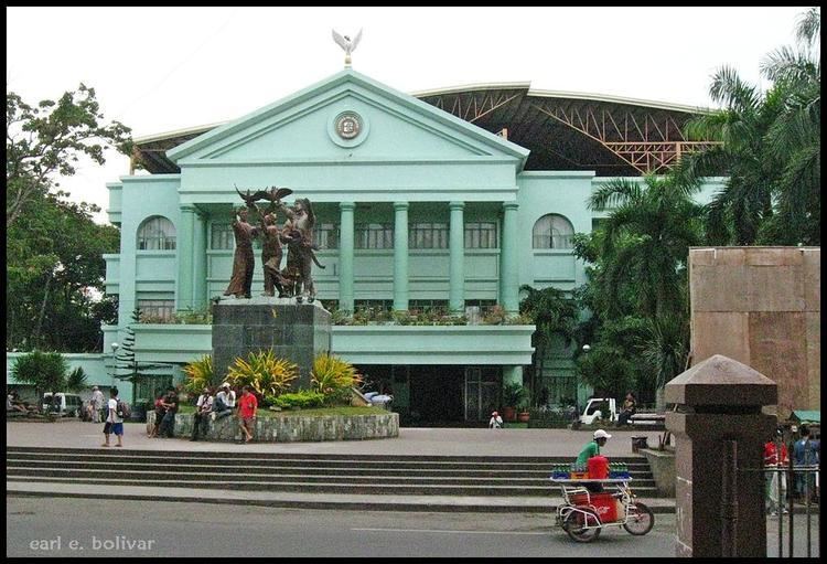
Davao del Sur (Filipino: Timog Dabaw) is a province of the Philippines located in the Davao Region in Mindanao. Its capital and largest city is Digos City. The province is bordered by Davao City to the north, the new province of Davao Occidental to the south and Cotabato, Sultan Kudarat, South Cotabato and Sarangani to the west. To the east lies the Davao Gulf.
Contents
- Map of Davao del Sur
- Davao del sur birds mammals and reptiles
- History
- Geography
- Art and culture
- Davao del Sur cuisine
- References
Map of Davao del Sur
Davao del sur birds mammals and reptiles
History
The beginnings of both Davao Region and Davao del Sur was associated with that of the foundation of Davao, which is the first town to be founded South of the island of Mindanao in 1848, following the conquest of the area by Don Jose Uyanguren of Guipuzcoa, Spain. In 1849, Nueva Guipuzcoa province was founded in the region conquered by Don Uyanguren in what is now Davao Region, with Davao, then called Nueva Vergara, as the provincial capital. Don Uyanguren, then the provincial governadorcillo, made some efforts to develop the areas he conquered, but failed.
Just thirty-six years after the foundation of Davao, the town of Sta. Cruz was founded on the 5th day of October, 1884. It is the first town to be founded south of Davao and is now the oldest in the province.
In 1898, the Spanish administration in the Philippines ended in 1898 following its defeat during the Spanish–American War. In early 1900s, waves of immigrants from the Visayas, Luzon, and as well as from Japan began to live in the region, centered mainly in Davao. The region began to boom in economic growth as agricultural business proliferated in the region.
As part of the "food bowl" of what is now the province of Davao del Sur, otherwise known as the Padada Valley, the agricultural area south of the town of Sta. Cruz, which is known as Digos that time, lured many migrants, majority of whom came from the Visayas and Ilocos regions to settle permanently in the area. Before World War II, an enterprising American by the name of N.E. Crumb leased 10.24 km² and transformed the place into an Abaca Plantation. This became the hub of economic activity in the locality during those days.
In 1942, during the start of the Second World War in the Pacific, the first waves of invading Japanese units landed and entered the province of southern Davao.
In 1945, the liberation in southern Davao by the United States and the Philippine Commonwealth troops was supported by the Davaoeño guerrilla fighters against the Japanese forces beginning to fighting in the Second World War.
In 1967, Davao Province was divided into three provinces, one of them being Davao del Sur; the town of Digos was made its capital and will become a suburban city for the next 33 years.
In October 28, 2013, along with the Barangay Elections, a plebiscite was held to create a new province Davao Occidental, formed out of the southern part of Davao del Sur, covering the municipalities of the 2nd district of the province, namely Don Marcelino, Jose Abad Santos, Sta. Maria, Sarangani and Malita (which was designated as the provincial capital) by virtue of Republic Act 10360 enacted on July 23, 2013, and the majority of votes cast were "Yes", ratifying the province.
Geography

Located in the southeastern corner of the countrys southernmost island of Mindanao, the province of Davao del Sur is bounded by the province of Davao del Norte to the north; Davao Occidental to the south-east; North Cotabato and Sultan Kudarat to the west; South Cotabato and Saranggani to the south-west ; and Davao Gulf to the east. The province is composed of sandy beaches and outlying islands, agricultural plains and valleys, rainforests, swamps, rolling hills and mountains, including the Philippines highest peak, Mount Apo, which is at 3,144 metres (10,315 ft) above sea level.
Its land area is 2,163.98 square kilometres (835.52 sq mi). When Davao City is included for geographical purposes, the provinces land area is 4,607.59 square kilometres (1,779.00 sq mi).
Art and culture
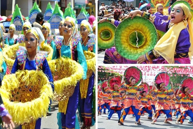
The colorful artistic heritage of Davao stems from the rich culture of its tribes. For the Bagobos, aesthetics is the meticulous carving of weapons; the elaborate decoration of inlaid metal boxes with bells; and the ornamentation of their abaca fiber dress with embroidery, shells, beads and metal discs. The Mandayas, on the other hand, have a solid tradition in weaving. To produce their famed coarse textured cloth, abaca fiber is colored with earth dyes and woven on a backstrap loom.
The final product is embroidered with bright-colored threads in geometric patterns. Some elements of tribal folklore are also included in the designs. The Mansakas, together with the Mandayas, are also expert silversmiths. They craft weapons, breastplates and dress accessories. Much of its people are Christians. Davao is also a harmonious blend of Christian and Muslim cultures. However, its most stunning cultural aspect is definitely its ethnic art which encompasses music, dance, religious ritual, dress and ornamentation.
Davao del Sur cuisine
The cuisine of Davao City features skewered and grilled meat dishes, but the most common dish served in the city is kinilaw, a relative of ceviche made from tuna, mackerel, or swordfish with cucumber (and sometimes radishes) and chili marinated in vinegar. Sinuglaw, a portmanteau of sinugba (grilled) and kinilaw in the Cebuano language, is also a term for a dish in which diced, grilled pork belly is mixed with kinilaw.
Fruit dishes, snacks, and desserts are also popular, most made from durian and bananas. Ginanggang is a banana dish that originated in this city and spread to other parts of the country; a banana is grilled, skewered, brushed with margarine and sprinkled with sugar. Durian dishes, snacks, and desserts include durian ice cream, durian pie and durian shakes.