
LLG Daru Urban Time zone AEST (UTC+10) Founded 1884 Population 20,053 (2013) | District South Fly District Established 1884 Climate Am Elevation 3 m Local time Saturday 8:55 AM Number of airports 1 | |
 | ||
Weather 27°C, Wind W at 2 km/h, 88% Humidity | ||
Lack of sports development in daru
Daru is the capital of the Western Province of Papua New Guinea. The township is entirely located on an island that goes by the same name, which is located near the mouth of the Fly River on the western side of the Gulf, just north of Torres Strait and Far North Queensland. Daru has approximately the same population as Tabubil and is the second-largest southern coastal settlement in Papua New Guinea after Port Moresby. Daru has about 13,000 inhabitants and is the biggest coastal village in western Papua New Guinea.
Contents
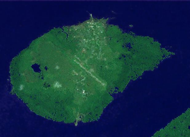
Map of Daru, Papua New Guinea
The language of the Daru people is Kiwai (South-West Coastal Kiwai), also spoken on neighbouring mainland villages (the name Kiwai comes from Kiwai Island further north-west in the Fly River delta). However, the Kiwai settlement of Daru is fairly recent. The original inhabitants, the Hiamo, were Western-Central Torres Strait Islanders originally from Yama in the Torres Strait. With the Kiwai colonisations, the main group of Hiamo people moved to Southern Torres Strait and settled the Muralag group.
It is served by Daru Airport, a small airstrip.