
District created 1966 Last contested 2015 | MP Darren FisherLiberal First contested 1968 District webpage profile, map Elector 73,066 | |
 | ||
Census division Halifax Regional Municipality | ||
Dartmouth—Cole Harbour (formerly Dartmouth and Dartmouth—Halifax East) is a federal electoral district in Nova Scotia, Canada, that has been represented in the House of Commons of Canada since 2004.
Contents
Demographics
From the 2006 census
Ethnic groups:
Languages:
Religions:
Education:
Median Age:
Median total income:
Average total income:
Median household income:
Average household income:
Median family income:
Average family income:
Unemployment:
Geography
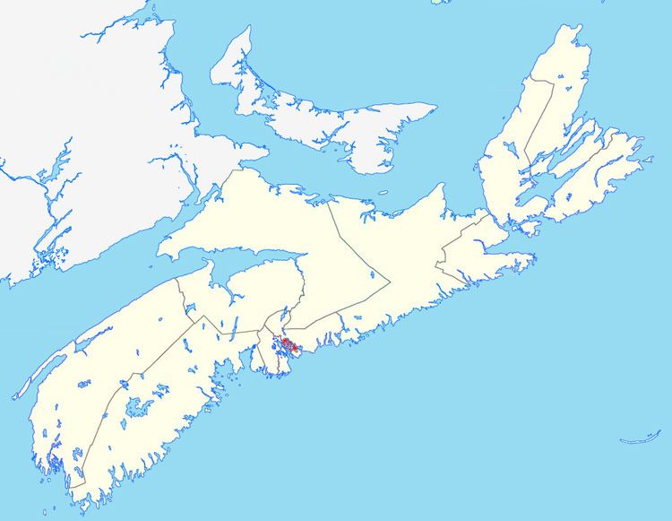
The district includes the Dartmouth and Cole Harbour areas of the Halifax Regional Municipality. The area is 89 km2.
Political geography
The Liberals and the NDP were the two main parties in 2008. The NDP saw much of its support in West Dartmouth, around Topsail Lake, the northern part of Cole Harbour, and the communities of Imperoyal and Woodside as well as the Cole Harbour 30 Indian Reserve. The Conservatives won two polls, both in Cole Harbour. The Liberals dominated in Central, Eastern and Northern Dartmouth and in southern Cole Harbour. [1]
History
The riding of Dartmouth—Halifax East was created in 1966 when the former dual-member Halifax riding was split into two. The district consisted of the Dartmouth area, Bedford and most of eastern Halifax County. Bedford was moved to the riding of Halifax West in a 1976 redistribution. In 1987, the Dartmouth riding was created, taking in nearly all of the former territory of Dartmouth—Halifax East.
The electoral district of Dartmouth—Cole Harbour in 2004 was created from 86.8% of the population of the new riding came from Dartmouth, and 13.2% from Sackville—Musquodoboit Valley—Eastern Shore.
The 2012 federal electoral redistribution concluded that this riding will remain largely the same for the 42nd Canadian federal election. It lost a small fraction to the new riding of Sackville—Preston—Chezzetcook and gained a small portion (2%) from what was Sackville—Eastern Shore.
Member of Parliament
These ridings have elected the following Members of Parliament:
Dartmouth
Change for the Canadian Alliance from 1997 are based on the results of its predecessor, the Reform Party.
Change for Independent candidate Cliff Williams is shown based on his results as a National Party candidate in 1993.