
Country Canada Founded 1750 Amalgamated with Halifax April 1, 1996 Local time Friday 6:48 PM | Incorporated City January 1, 1961 Population 67,573 (2011) Area code Area codes 902 and 782 | |
 | ||
Neighbourhoods Albro Lake, Bell Ayr Park, Brightwood, Burnside, Commodore Park, Crichton Park, Crystal Heights, Downtown Dartmouth, Ellenvale, Grahams Corner, Greenough Settlement, Harbourview, Highfield Park, Imperoyal, Manor Park, Nantucket, Port Wallace, Portland Estates, Portland Hills, Shannon Park, Southdale, Tam O'Shanter Ridge, Tufts Cove, Wallace Heights, Woodlawn, Woodside Weather -3°C, Wind W at 16 km/h, 37% Humidity | ||
Shubie park dartmouth nova scotia
Dartmouth is a community and former city in the Halifax Regional Municipality of Nova Scotia, Canada. Dartmouth is located on the eastern shore of Halifax Harbour. Dartmouth has been nicknamed the City of Lakes, after the large number of lakes located within its boundaries.
Contents
- Shubie park dartmouth nova scotia
- Map of Dartmouth NS Canada
- History
- Municipal government
- Economy
- Transportation
- Communications
- Natal Day
- Geography
- Military
- Notable people
- Symbols
- Culture
- References
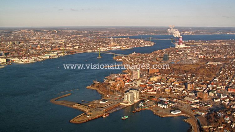
Map of Dartmouth, NS, Canada
On April 1, 1996, the provincial government amalgamated all the municipalities within the boundaries of Halifax County into a single-tier regional government named the Halifax Regional Municipality (HRM). Dartmouth and its neighbouring city of Halifax, the town of Bedford and the Municipality of the County of Halifax were dissolved. The former city of Dartmouth forms part of the urban core of the larger regional municipality and is officially designated as part of the "capital district" by the Halifax Regional Municipality. At the time that the City of Dartmouth was dissolved, the provincial government altered its status to a separate community to Halifax; however, its status as part of the metropolitan "Halifax" urban core existed prior to municipal reorganization in 1996.
Dartmouth is still an official geographic name that is used by all levels of government for legal purposes, postal service, mapping, 9-1-1 emergency response, municipal planning, and is recognized by the Halifax Regional Municipality as a civic addressing community. The official place name did not change, due to the confusion with similar street names, land use planning set out by the former "City of Dartmouth," and significant public pressure. Today the same development planning for Downtown Dartmouth and the rest of the region is still in force, as well as specific bylaws created prior to April 1, 1996.
History
Father Le Loutre's War began when Edward Cornwallis arrived to establish Halifax with 13 transports on June 21, 1749. By unilaterally establishing Halifax, the British were violating earlier treaties with the Mi'kmaq (1726), which were signed after Father Rale's War. The British quickly began to build other settlements. To guard against Mi'kmaq, Acadian and French attacks on the new Protestant settlements, British fortifications were erected in Halifax (1749), Dartmouth (1750), Bedford (Fort Sackville) (1751), Lunenburg (1753) and Lawrencetown (1754).
In 1750, the sailing ship Alderney arrived with 151 immigrants. Municipal officials at Halifax decided that these new arrivals should be settled on the eastern side of Halifax Harbour. During the early years, there were 8 Acadian and Mi'kmaq raids on the new British settlement, such as the Raid on Dartmouth (1751).
The original settlement was made in an area the Mi'kmaq called Ponamogoatitjg (Boonamoogwaddy), which has been varyingly translated as "Tomcod Ground" or "Salmon Place" in reference to the fish which were presumably caught in this part of Halifax Harbour. The community was later given the English name of Dartmouth in honour of William Legge, 1st Earl of Dartmouth who was a former Secretary of State. By 1752, 53 families consisting of 193 people lived in the community.
Dartmouth was initially a sawmill and agricultural outpost of Halifax. However, in the mid 19th century, it grew, first with the construction of the Shubenacadie Canal and more importantly with the rise of successful industrial firms such as the Dartmouth Marine Slips, the Starr Manufacturing Company, and the Stairs Ropeworks.
In 1873, Dartmouth was incorporated as a town and a Town Hall was established in 1877. In 1955, the town was permanently linked to Halifax by the Angus L. Macdonald Bridge which led to rapid suburban growth. The Town of Dartmouth amalgamated with several neighbouring villages into the City of Dartmouth in 1961. The A. Murray MacKay Bridge opened in 1970, furthering commercial and residential growth.
The city was dissolved on April 1, 1996, when its government was amalgamated into the Halifax Regional Municipality.
Municipal government
Dartmouth is represented municipally in Halifax Regional Council by the following districts:
The HRM community council for Dartmouth is the Harbour East - Marine Drive Community Council are held in various locations on the first Thursday of every month.
Residents of Dartmouth are known as Dartmouthians. As a community, Dartmouth has often tended to distinguish itself from the community and former city of Halifax, even under the present municipal amalgamation. Dartmouth is also the Halifax Regional Municipality's Public Works Eastern Region.
Economy
The city was not only a bedroom community for Halifax, but also had commerce and industries of its own, including the Volvo Halifax Assembly plant, and a molasses plant dating back to the days of the triangular trade with the West Indies. Today, Dartmouth is home to the shopping district of Dartmouth Crossing, as well as federal government offices, many located in the Queen Square building on Alderney Drive.
Transportation
Dartmouth is linked to Halifax by the oldest continuously operating salt water ferry service in North America with the first crossing having taken place in 1752. Early ferries were powered by horses, which were replaced with steam engines in 1830. During the early 20th century, ferries shuttled pedestrians and vehicles between the downtown areas of Halifax and Dartmouth. A railway trestle was built across Halifax Harbour in the late 19th century to bring rail service to Dartmouth however it was destroyed by a storm, requiring the present railway connection built around Bedford Basin.
During the early 1950s, construction began on the Angus L. Macdonald Bridge, a suspension bridge crossing Halifax Harbour. It opened in 1955, ushering in an unprecedented development boom in Dartmouth. New subdivisions, shopping centres, office buildings and industrial parks have been built in recent decades. A second bridge, the A. Murray MacKay Bridge was opened in 1970 and the Highway 111 Circumferential Highway was built around Dartmouth to Woodside at this time.
Communications
Natal Day
Geography
Neighbourhoods of Dartmouth include:
The oldest structure in Dartmouth is the house of William Ray, a Quaker and cooper from Nantucket who moved to Dartmouth in 1785-86 as a whaler. Its materials and construction methods closely resembles Quaker architecture in Nantucket, such as the asymmetrical facade design and stone foundation. It is located at 59 Ochterloney Street and is believed to have been built around 1785 or 1786. Today it is a museum, furnished as a typical modest dwelling of a merchant of that time.
Dartmouth's first city hall was built in the early 1960s on land with the Dartmouth Common. On May 4, 2007, a Halifax Regional Municipality news release stated that the building was to be demolished. The land has since been restored to parkland.
Military
Dartmouth has been home to several Canadian Forces installations: