
Elevation 2,738 m | Topo map USGS Sams | |
 | ||
Location Ouray / San Miguel counties, Colorado, U.S. Similar San Juan Mountains, Mount Sneffels, Rocky Mountains, Lizard Head Pass, Wilson Peak | ||
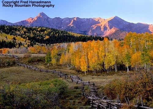
Dallas Divide (el. 8,983 feet (2,738 m)) is a high mountain pass in the United States state of Colorado located on State Highway 62 about 12 miles (19 km) west of the town of Ridgway.
Contents
- Map of Dallas Divide Colorado 81432 USA
- Last dollar road from dallas divide towards telluride
- References
Map of Dallas Divide, Colorado 81432, USA
The pass is a saddle between the San Juan Mountains to the south and the Uncompahgre Plateau to the north and divides the Uncompahgre River watershed from the San Miguel River watershed and Ouray County from San Miguel County. The pass takes its name from Dallas Creek which drains the basin on the north side of Mount Sneffels into the Uncompahgre River. The divide's namesake is George M. Dallas, 11th Vice President of the United States.
The summit is not marked at the top, so travelers over the road may not notice they have just traversed the divide. The approach on either side is mild and does not cause many cars or trucks problems in winter.
A toll road was first constructed over Dallas Divide in 1880 linking the town of Dallas near Ridgway with Telluride. In 1890 the Rio Grande Southern Railroad was built over the divide from Ridgway to Telluride.