
Length 37.67 km | ||
 | ||
Counties | ||
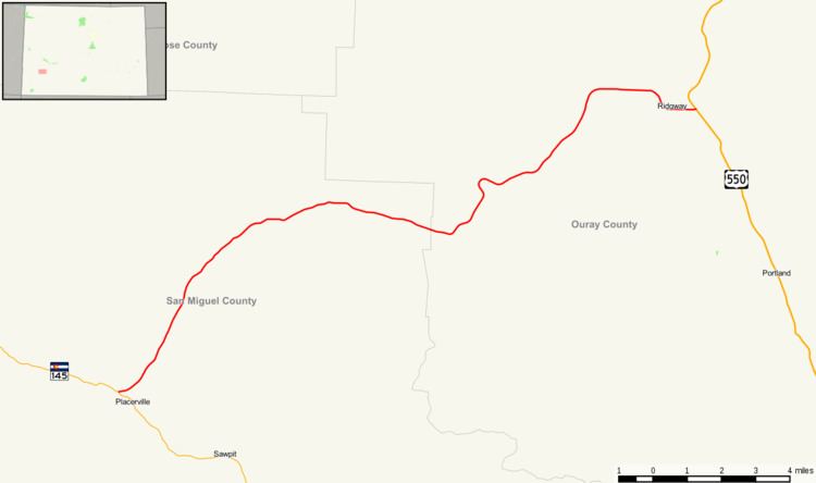
State Highway 62 is a 23.41 mile (37.67 km) long state highway in the U.S. state of Colorado.
Contents
Map of Co Hwy 62, Alkol, WV 25501, USA
Route description
SH 62 starts at a junction with SH 145 just north of Placerville, Colorado in the San Miguel River valley and heads northeast up the Leopard Creek Canyon. The highway bends slowly to the east before crossing the Dallas Divide at an elevation of 8,983 feet (2,738 m). It then follows Cottonwood and Dallas creeks downstream to Ridgway, Colorado. The highway crosses the Uncompahgre River just before ending at a junction with US 550.
State Highway 62 is part of the San Juan Skyway, designated as a National Scenic Byway in 1996.
References
Colorado State Highway 62 Wikipedia(Text) CC BY-SA