
Country Netherlands Time zone CET (UTC+1) Website www.dalfsen.nl Elevation 3 m | Demonym(s) Dalfsenaar, Dalfser Area code 0529, 0572 Area 166.5 km² Local time Thursday 3:34 AM | |
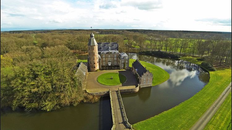 | ||
Postcode 7710–7714, 7720–7729, 8150–8159 Weather 4°C, Wind S at 10 km/h, 100% Humidity Points of interest Rechteren Castle, Ruitenborgh, Den Aalshorst | ||
Dalfsen ( pronunciation , Dutch Low Saxon: Dalsen) is a municipality and a town in the Salland region of the Dutch province of Overijssel. The municipality of Dalfsen was increased to its current size on 1 January 2001 through the amalgamation of the municipalities of Nieuwleusen and Dalfsen.
Contents
Map of Dalfsen, Netherlands
History
The name first appears in documents in 1231. Due to the closeness of Kasteel Rechteren, Dalfsen is one of several towns along the Overijssel section of the Vecht river never to have received city rights.
Population centres
Ankum, Dalfsen, Dalfserveld, Dalmsholte, De Marshoek, De Meele, Emmen, Gerner, Hessum, Hoonhorst, Lemelerveld, Lenthe, Leusenerveld, Nieuwleusen, Oudleusen, Oudleusenerveld, Rechteren, Strenkhaar and Welsum.
Dutch Topographic map of the municipality of Dalfsen, June 2015.