
River mouth Agout110 m (360 ft) Length 116 km Mouth Agout | Basin size 858 km (331 sq mi) Basin area 858 km² | |
 | ||
Main source Saint-Salvi-de-Carcavès860 m (2,820 ft) Discharge Average rate:12 m/s (420 cu ft/s) | ||
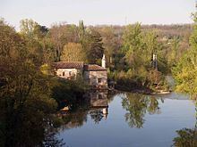
The Dadou (French: le Dadou) is a 115.9 km (72.0 mi) long river in the Tarn département, southern France. Its source is near Saint-Salvi-de-Carcavès. It flows generally west. It is a right tributary of the Agout into which it flows near Ambres.
Contents
Map of Le Dadou, France
Communes along its course
The Dadou flows west, crossing the Tarn département, through the following communes, ordered from source to mouth: Saint-Salvi-de-Carcavès, Le Masnau-Massuguiès, Lacaze, Paulinet, Rayssac, Mont-Roc, Teillet, Le Travet, Arifat, Saint-Antonin-de-Lacalm, Montredon-Labessonnié, Saint-Lieux-Lafenasse, Vénès, Réalmont, Saint-Genest-de-Contest, Lombers, Laboutarie, Montdragon, Saint-Julien-du-Puy, Graulhet, Briatexte, Saint-Gauzens, Puybegon, Giroussens, Ambres
References
Dadou Wikipedia(Text) CC BY-SA