
OS grid reference SP5010 Sovereign state United Kingdom Dialling code 01865 | Civil parish unparished District Oxford | |
 | ||
A trip on the cutteslowe park miniature railway
Cutteslowe is a suburb of north Oxford, England, between Sunnymead and Water Eaton.
Contents
- A trip on the cutteslowe park miniature railway
- Map of Cutteslowe Oxford UK
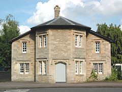
- Cutteslowe park and miniature railway
- Manor
- Turnpike
- Cutteslowe Walls
- Cutteslowe Park
- References
Map of Cutteslowe, Oxford, UK
Cutteslowe park and miniature railway
Manor
By AD 1004 St Frideswide's Minster in Oxford held two hides of land at Cutteslowe. St Frideswide's became an Augustinian Priory, which continued to hold Cutteslowe until it was suppressed in 1525. It then passed to Cardinal Wolsey's Cardinal's College until Wolsey's downfall and attainder in 1529. Cardinal's College became King Henry VIII's College until 1545.
Cutteslowe changed hands three times before it was bought in about 1588 by William Lenthall, grandfather of the William Lenthall who was Speaker of the Long Parliament. Between 1611 and 1625 John Lenthall sold Cutteslowe to Sir John Walter of Sarsden near Churchill, Oxfordshire. Most of the estate was sold by a later Sir John Walter in 1703, and by 1737 had been acquired by Christ Church, Oxford. Sir John sold about 22 acres (8.9 ha) to Dr Robert South who used it to endow his school at Islip, Oxfordshire.
Sir John sold most of what remained in 1710 to John Churchill, 1st Duke of Marlborough, in whose family it remained until 1811, when George Spencer-Churchill, 6th Duke of Marlborough sold or exchanged his part to Francis Gregory. In 1918 Gregory's granddaughters sold Cutteslowe to the Soden family. The Sodens sold some of the land for development in 1931 and the remainder to Oxford City Council in 1936, which turned it into Cutteslowe Park.
Turnpike
The main road between Oxford and Banbury passes through Cutteslowe. It was turnpiked in the 18th century and disturnpiked in the 19th century.
Cutteslowe Walls
Between 1934 and 1959 Cutteslowe was the location of two very contentious barriers, the Cutteslowe Walls, designed to keep council house tenants in the Cutteslowe Estate out of a development of private houses between them and Banbury Road. The northern wall divided Wolsey Road from Carlton Road, the southern Aldrich Road from Wentworth Road.
During the Second World War a tank whose crew was trying to return from Banbury Road to its base on Elsfield Way took a wrong turn and demolished one of the walls rather than turn back. The wall was rebuilt, but after escalating public protests and several unofficial attempts the walls were eventually officially demolished.
A small fragment of the Aldrich Road wall existed in a private garden in Wentworth Road until the 1980s. A blue plaque was erected by the Oxfordshire Blue Plaques Board close to the site of the southern wall in 2006.
Cutteslowe Park
North of the A40 Elsfield Way is Cutteslowe Park, which was made a public park in the 1930s.