
Founded 1981 Area code(s) (+56) 45 Area 1,171 km² | Elevation 406 m (1,332 ft) Website www.curarrehue.cl Local time Monday 2:42 PM | |
 | ||
Weather 22°C, Wind W at 8 km/h, 52% Humidity | ||
Curarrehue session 2010 parte 4 snowboard hd cesar curitol
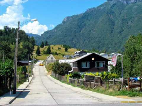
Curarrehue ([kuɾaˈrewe]) is a town and commune in Cautín Province of Araucanía Region, Chile. The origin of Curarrehue dates back to the occupation of Araucanía and the Conquest of the Desert by the Chilean and Argentine army respectively in the 1870s and 1880s when Mapuches were pushed by the Argentine Army through Mamuil Malal Pass into the valley of Curarrehue where they settled.
Contents
- Curarrehue session 2010 parte 4 snowboard hd cesar curitol
- Map of Curarrehue Araucania Chile
- Curarrehue session 2010 parte 5 snowboard hd cesar curitol
- Demographics
- Administration
- References
Map of Curarrehue, Araucania, Chile
Geologically the town of Curarrehue is placed on the Reigolil-Pirihueico Fault.
Curarrehue session 2010 parte 5 snowboard hd cesar curitol
Demographics
According to the 2002 census of the National Statistics Institute, Curarrehue spans an area of 1,170.7 km2 (452 sq mi) and has 6,784 inhabitants (3,586 men and 3,198 women). Of these, 1,862 (27.4%) lived in urban areas and 4,922 (72.6%) in rural areas. The population grew by 13.5% (806 persons) between the 1992 and 2002 censuses.
Administration
As a commune, Curarrehue is a third-level administrative division of Chile administered by a municipal council, headed by an alcalde who is directly elected every four years. The 2008-2012 alcalde is Héctor Carrasco Ruiz (RN).
Within the electoral divisions of Chile, Curarrehue is represented in the Chamber of Deputies by René Manuel García (RN) and Fernando Meza (PRSD) as part of the 52nd electoral district, (together with Cunco, Pucón, Villarrica, Loncoche, Gorbea and Toltén). The commune is represented in the Senate by José Garcia Ruminot (RN) and Eugenio Tuma Zedan (PPD) as part of the 15th senatorial constituency (Araucanía-South).