
OS grid reference TQ445595 Sovereign state United Kingdom Local time Monday 9:04 AM | Postcode district TN14 Dialling code 01959 | |
 | ||
Weather 4°C, Wind W at 8 km/h, 91% Humidity | ||
Cudham is a village in the London Borough of Bromley. It is located on the Greater London border with Kent bordering the Sevenoaks District. It lies south of Orpington and north west of Sevenoaks. It located 15.5 miles (24.9 km) south-southeast of Charing Cross.
Contents
Map of Cudham, UK
History
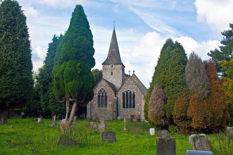
Cudham church, dedicated to St Peter & St Paul, is mentioned in the Domesday Book. The Blacksmith's Arms, originally a 17th-century farmhouse, has memorabilia of the music hall artiste known as "Little Tich". Cudham was part of Bromley Rural District from 1894 and Orpington Urban District from 1934 to 1965. The village was therefore part of Kent (and therefore administered by Kent County Council) until the creation of Greater London on 1 April 1965. Cudham Recreation Ground, behind the church and pub, is home to Cudham Wyse Cricket Club, which was formed in 1965.
Transport
Cudham is served by Transport for London bus services R5 and R10 connecting the area with Orpington via Green Street Green and to Knockholt. The closest rail link to the area is Knockholt station.
Events
Cudham hosts one of the oldest village shows and fetes dating back to Victorian times, annually on the August Bank Holiday Monday.
Cudham also hosts the famous annual Cudham Craic music festival, a popular 2 day music event in Cudham's recreation ground promoted by KentBand.com.