
OS grid reference TQ385795 Sovereign state United Kingdom Dialling code 20 | Postcode district E14 | |
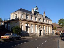 | ||
Pest control london cubitt town
Cubitt Town is an area on the Isle of Dogs in Tower Hamlets in London, England. It is on the east of the Isle, facing Greenwich across the River Thames. To the west is Millwall, to the northwest Canary Wharf and to the north, across the Blue Bridge, Blackwall. It is in Blackwall & Cubitt Town Ward of Tower Hamlets London Borough Council.
Contents
- Pest control london cubitt town
- Map of Cubitt Town London UK
- History
- Shipbuilding
- Other industries
- Housing
- Learning and education
- Primary schools
- Secondary school
- Recreation
- Metro
- Buses
- Roads
- Cycling walking
- Nearest places
- References
Map of Cubitt Town, London, UK
History
It is named after William Cubitt, Lord Mayor of London (1860–1862), who was responsible for the development of the housing and amenities of the area in the 1840s and 1850s, mainly to house the growing population of workers in the local docks, shipbuilding yards and factories. As it grew, Cubitt also created many local businesses employing manual labourers as well as the streets of housing to accommodate them.
Shipbuilding
For many years this area was home to a number of shipbuilders, such as Westwood, Baillie, Samuda Brothers, J & W Dudgeon and Yarrow Shipbuilders. Noteworthy ships launched here included
Other industries
The businesses included those involved in cement, pottery and brick production. Asphalt production was another growth industry, coinciding with the growth, development, and industrialisation of areas throughout the British Isles. In Cubitt Town, the Pyrimont Wharf was developed in 1861 by the Asphalte de Seyssel Company of Thames Embankment (later known as the Seyssel Asphalte Company or Seyssel Pyrimont Asphalte Company), with asphalt production taken over in the 1870s by Claridge's Patent Asphalte Company.
Housing
Estates in the area include:
The area is a mix of old east London working-class communities transplanted into 1960s and 1970s high-rise estates and the middle-class workers in the Canary Wharf complex attracted by relatively low prices for riverside living, plus less recent Bangladeshi and East Asian immigrant populations.
Learning and education
A public library was financed by Andrew Carnegie and built by C. Harrold Norton, being completed in 1905. Will Crooks, the then Mayor of Poplar had attended a meeting at the Guildhall, where Carnegie had promised to fund public libraries. Crooks was able to get a commitment form him to pay for two libraries, this one in Cubitt Town and another in Bromley by Bow. Carenegie agreed to provide £15,00 for both together. The total expense for this building was £6,805 13s 10d, which included some neighbouring land which originally served as a public garden before providing space for an extension to be used a meeting hall and erected in 1962.
The building is currently owned by the Tower Hamlets London Borough Council as part of their library service.
Primary schools
Secondary school
Recreation
Cubitt town is home to a number of recreational facilities:
Metro
The nearest stations are Crossharbour and Island Gardens on the Docklands Light Railway, both opened on the 31 August 1987.
Buses
Roads
Cubitt Town is connected to the National Road Network by the north-south Manchester Road A1206.
Cycling & walking
Access across the River Thames is by the Greenwich Foot Tunnel and the National Cycle Route 1 to the west (which also uses the Greenwich Foot Tunnel).