
Population 530 (2011 Census) Sovereign state United Kingdom Local time Sunday 9:52 PM District Borough of Melton | OS grid reference SK835295 Post town GRANTHAM Dialling code 01476 | |
 | ||
Weather 4°C, Wind NW at 19 km/h, 91% Humidity | ||
Croxton Kerrial (pronounced "crow-sun kerry-ul" [ˈkroʊsən ˈkɛrɨl]) is a village and civil parish in the Melton borough of Leicestershire, England. It is 6.6 miles (10.6 km) to the southwest of Grantham and 7.9 miles (12.7 km) northeast of Melton Mowbray—0.5 miles (0.8 km) west of Leicestershire's boundary with Lincolnshire. The civil parish of Croxton Kerrial, which includes the outlying hamlet of Branston, had a population of 490 in 2001,Increasing to 530 at the 2011 census.
Contents
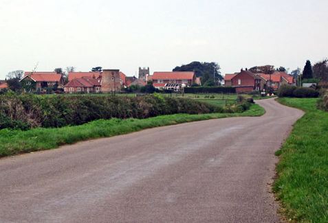
Map of Croxton Kerrial, Grantham, UK
History
In medieval times, Croxton Abbey, a Premonstratensian house, lay within the locality.
Governance
Lying across the historic county boundaries of Leicestershire and Lincolnshire from a very early time, Croxton Kerrial once formed an ancient parish within the hundred of Framland.
From 1894 to 1935, Croxton Kerrial formed part of the Belvoir Rural District, when it was amalgamated into Melton and Belvoir Rural District, both of which were within the administrative county of Leicestershire.
In 1974, as part of the provisions of the Local Government Act 1972, Croxton Kerrial was transferred into the newly created non-metropolitan district of Melton, though it remained within the county of Leicestershire.
Geography
Croxton Kerrial can be described as a hilly area, with the highest point within the locality being five hundred feet above sea level. Nearby Branston lies much lower. Much of the land surrounding Croxton Kerrial is arable, and has been used as farmland for centuries.
Nearby places are Knipton and Harston (both in Belvoir parish), Belvoir Castle, Hungerton (over the border in Lincolnshire), Eaton and Sproxton. South Croxton is a separate village and civil parish in the Charnwood borough of Leicestershire, named with reference to its situation south of Croxton Kerrial.
Landmarks
Croxton Kerrial Church of England Primary School converted to academy status in 2013 under the Leicester Diocese Charitable Trust. An Ofsted report in June 2015 graded the school as good. It had a roll of 73.
A local landmark is the "Croxton Water Spout", part of an old water system sourced from a local spring which was refurbished in 2003 as part of the Millennium celebrations.
The local Anglican church - part of the Diocese of Leicester - is dedicated to both Saint Botolph and Saint John the Baptist. There is a former Methodist chapel in the village.
Southwest of the village (beyond Croxton Park) at grid reference SK814265 is the disused Croxton Park racecourse. Its last meeting was on 2 April 1914.
Sport
Croxton Kerrial currently has one senior football team, CK Dons, who play in the Leicester and District Football League.
Croxton also has a Sunday cricket team, who play in the GMCA Division 3.