
River mouth 52 ft (16 m) | Tributaries Left:Cedar Brook | |
 | ||
Progression | ||
Cranbury Brook, also known as Cranberry Brook, is a tributary of the Millstone River in Middlesex and Monmouth Counties, New Jersey in the United States.
Contents
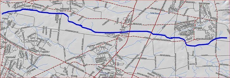
Map of Cranbury Brook, Plainsboro Township, NJ, USA
Course
Cranbury Brook starts at 40°15′37″N 74°24′5″W, near the intersection of SR-33, Dugans Grove Road, and Iron Ore Road. It flows westward, crossing Perrineville Road. It receives several tributaries from the area and crosses Union Valley Road and Applegarth Road. It then crosses the New Jersey Turnpike, and is dammed to form Brainerd Lake. As a lake it crosses Route 130 and South Main Street in the town of Cranbury. It continues flowing west through the Cranbury Preserve and receives the Cedar Brook. It then crosses George Davison Ave and forms another dammed section known as Plainsboro Pond. It then crosses Maple Ave and drains into the Millstone River at 40°19′26″N 74°36′47″W.
Accessibility
Cranbury Brook is easily accessed by many road crossings and dammed sections such as Brainerd Lake.