
River mouth 79 ft (24 m) | ||
 | ||
Bridges Salem-Shotwell Covered Bridge | ||
Rocky Brook is a tributary of the Millstone River in Monmouth and Mercer counties, New Jersey in the United States.
Contents
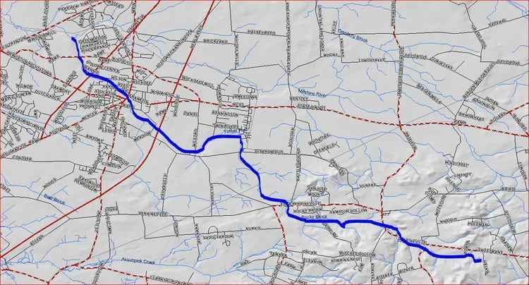
Map of Rocky Brook, New Jersey, USA
Course
Rocky Brook starts at 40°13′8″N 74°24′37″W, near Perrineville. It flows parallel to CR-1 (Sweetmans Lane) before draining into Perrineville Lake. It continues flowing west into the northern areas of Perrineville Lake Park. It then turns northwest and crosses Perrineville Road and flows through the Etra Road Open Space area. It crosses Disbrow Hill Road and drains into the Etra Lake at 40°15′13″N 74°29′59″W. It continues flowing west alongside Etra Road and crosses the New Jersey Turnpike. It then flows into Peddie Lake in the heart of Hightstown. It crosses Route 33 and flows past the Town Center Plaza and Shopping Center before crossing Route 130 and the Hightstown Bypass. It then flows alongside the East Windsor Open Space Acquisition before draining into the Millstone River at 40°17′18″N 74°32′23″W.