
River mouth Huzzah Creek Length 62 km | Basin size 222 sq mi (570 km) Basin area 575 km² | |
 | ||
Discharge Average rate:250–500 cu ft/s (7.1–14.2 m/s) | ||
Courtois creek
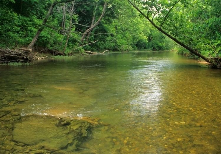
Courtois Creek ( /ˈkoʊtəweɪ/) is a 38.6-mile-long (62.1 km) stream in southern Missouri, U.S.A. It shares its name with the nearby town of Courtois. According to the information in the Ramsay Place Names File at the University of Missouri, the creek was "doubtless named for some French settler, but his identity has not been ascertained".
Contents
- Courtois creek
- Map of Courtois Creek Liberty Township MO USA
- Float trip courtois creek in missouri cliff jumpin 6 11 11
- References
Map of Courtois Creek, Liberty Township, MO, USA
The stream arises in the Mark Twain National Forest in northern Iron County just north of Missouri Route 32 about four miles east of Bixby and flows north passing about four miles east of Viburnum. The stream enters the southwest corner of Washington County, flows past Courtois and on north through the Mark Twain National Forest entering Crawford County just south of Berryman and passesunder Missouri Route 8 just west of that village. It flows on northwest through the Missouri Ozarks of Crawford County, roughly paralleling the course of Huzzah Creek to its west. It flows into Huzzah Creek just before the latter's confluence with the Meramec River near the Crawford County Highway E bridge just east of Scotia.
The creek is popular year-round for canoeing, kayaking, and rafting. It is surrounded by dense stands of trees and native vegetation, has abundant fish, turtles and waterfowl, and is the best-protected stream in the area against erosion. The St. Louis Riverfront Times cited the creek as the best local float trip in 2007.