
Length 82.16 km | ||
 | ||
Counties | ||
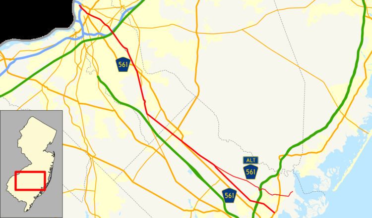
County Route 561, abbreviated CR 561, is a county highway in the U.S. state of New Jersey. The highway extends 51.05 miles (82.16 km) from New York Road (U.S. Route 9) in Galloway Township to Federal Street (CR 537) in Camden.
Contents
Map of County Rte 561, New Jersey, USA
Atlantic County
CR 561 begins at an intersection with US 9 in Galloway Township, Atlantic County (near the Stockton Seaview Resort), heading northwest on two-lane undivided Jimmie Leeds Road. The road passes through densely forested areas with some homes, intersecting CR 634 and CR 654. The route turns more to the west and passes under the Garden State Parkway, with access to that road via Exit 41. CR 561 heads west into the community of Pomona, running between forests to the north and wooded residential and commercial development to the south and passing AtlantiCare Regional Medical Center Mainland Division. The route splits from Jimmie Leeds Road by turning northwest onto Duerer Street, with CR 633 continuing west along Jimmie Leeds Road. The road passes through dense forests and crosses CR 575 prior to running through a mix of farmland and woodland. CR 561 reaches the CR 614 junction and continues through more rural areas. After crossing CR 674, the route enters Egg Harbor City and passes through forested residential areas. CR 561 intersects CR 563 and heads into dense woodland, crossing into Mullica Township at the Hamburg Avenue junction.
The road runs through more forests with a few homes, coming to an intersection with CR 561 Alternate. At this point, CR 561 continues northwest along Moss Mill Road and runs through more woodland, passing a farm to the southwest to the road. The route crosses CR 658 and CR 623 as it runs northwest through dense forests for several miles, eventually entering Hammonton. In this area, CR 561 crosses US 30 and CR 640 as it becomes Egg Harbor Road and passes through woodland along with some homes, with the route following a brief one-way pair at the CR 602 junction. The road passes woods to the northeast and industrial establishments to the southwest prior to crossing a branch of Hammonton Lake and passing homes and businesses. CR 561 northbound forms a brief concurrency with Route 54 as it crosses New Jersey Transit's Atlantic City Line in the commercial downtown area of Hammonton. The southbound direction of CR 561 crosseses the tracks at Orchard Avenue and does not form a concurrecy with NJ 54. The route continues northwest on Egg Harbor Road and passes through residential areas, running immediately to the southwest of the Atlantic City Line. At the CR 678 junction, CR 561 heads farther from the railroad tracks into more rural areas of homes, intersecting the northern terminus of CR 559.
Camden County
CR 561 continues into Winslow Township in Camden County and becomes Cedarbrook Road as it heads into a mix of farmland, woodland, and homes. In an area of woods, the road crosses under a Conrail Shared Assets Operations railroad line before crossing over another Conrail line as it reaches the CR 725 junction. The route crosses a Southern Railroad of New Jersey line a short distance later and runs through more woodland as it crosses CR 723. CR 561 passes through wooded areas of homes as it intersects Route 143 and CR 726. The route runs through a mix of farms, woods, and development as it comes to the Route 73 junction. At this junction, CR 561 Spur meets the route and CR 561 forms a concurrency with four-lane Route 73. The road intersects CR 722 and CR 721, becoming Camden Road at the latter junction. It heads north through more rural areas, meeting CR 720. CR 561C, a former segment of CR 561, splits from Route 73 by heading north through the community of Cedar Brook while Route 73 and CR 561 bypass the community to the east, crossing under a Conrail Shared Assets Operations railroad line. North of Cedar Brook, the route traverses CR 536, becoming Cedarbrook Road. It intersects CR 680 and CR 711 before widening into a divided highway prior to a junction where CR 712 heads northeast and CR 561 splits from Route 73 by heading north on two-lane Cedarbrook Road.
The road continues through a mix of farmland and woodland with some residences as it crosses CR 710 and CR 536 Spur. The route becomes Tansboro Road at the intersection with the latter and enters Berlin, passing residences and a few businesses before intersecting CR 720 and US 30. At this point, CR 561 turns north to follow US 30 on the White Horse Pike, with CR 534 joining the road from the east. The road runs through the commercial center of Berlin, with CR 561 splitting from US 30/CR 534 by heading north onto Haddon Avenue and coming to a bridge over the Atlantic City Line. The road continues into Berlin Township and runs northwest past homes as well as some businesses, crossing CR 692. The route enters Voorhees Township and intersects CR 693 as it widens to four lanes and heads into more wooded areas of development, forming the border between Gibbsboro to the west and Voorhees Township to the east. CR 561D continues north on Haddon Avenue, with CR 561 becoming Haddonfield-Berlin Road as it fully enters Gibbsboro and bypasses the community through wooded areas to the northeast. Along this stretch, the route intersects CR 685 and CR 686. After heading back into Voorhees Township, the road comes to a junction with CR 561A and gains a center left-turn lane as it continues northwest into commercial areas, crossing CR 673. CR 561 passes through residential and business areas as a four-lane road, coming to an intersection with CR 544 and CR 678. At this intersection, the route enters Cherry Hill and passes near residential subdivisions before meeting CR 670 in commercial areas. The road passes over the New Jersey Turnpike and comes to an interchange with I-295 a short distance later.
CR 561 runs near more homes before coming to the southern terminus of Route 154. The route passes a few commercial establishments before passing more residences and reaching the CR 671 junction. At this point, CR 561 continues into Haddonfield as two-lane Ellis Street, intersecting CR 644 before passing homes and making a turn northwest onto Haddon Avenue. The route crosses Route 41/CR 573 in the commercial downtown of Haddonfield prior to running through wooded neighborhoods. After passing over the Atlantic City Line, the road crosses into Haddon Township and passes through the commercial downtown of the Westmont part of the township, intersecting CR 642 and CR 643. At the CR 636 junction, CR 561 enters Collingswood and heads to the west through residential and business areas before coming to intersections with CR 640 and CR 630 in the commercial downtown. The route passes more homes, crossing CR 612 and coming to an interchange with US 30/US 130. At the CR 606 junction, the road heads into Camden and comes to CR 606 Alternate as it runs between urban industrial establishments to the southwest and Harleigh Cemetery to the northeast. The route passes Our Lady of Lourdes Medical Center along with rowhomes, crossing CR 607. CR 561 passes under the PATCO Speedline and a Conrail Shared Assets Operations railroad line prior to running under I-676 and coming into the commercial downtown of Camden and inersecting CR 604. The road passes Cooper University Hospital and crosses Martin Luther King, Jr. Boulevard and New Jersey Transit's River Line as it turns north onto a six-lane divided highway. CR 561 reaches its northern terminus at an intersection with CR 537.
CR 561 Alternate
County Route 561 Alternate, abbreviated CR 561 Alt, is a county highway in the U.S. state of New Jersey. The highway extends 15.79 miles (25.41 km) from a dead end on Moss Mill Road in Galloway Township to Duerer Street (CR 561) in Mullica Township.
The road travels through the following municipalities (from South to North):
Major intersections
The entire route is in Atlantic County.