
Airport type Public Website ci.corvallis.or.us/... Code CVO Phone +1 541-766-6916 | Owner City of Corvallis Elevation AMSL 250 ft / 76 m 17/35 5,900 Elevation 75 m | |
 | ||
Address 5695 SW Airport Ave, Corvallis, OR 97333, USA Similar Hilton Garden Inn Corvallis, Corvallis Hilton Gardens I, Corvallis (OSU Memorial, Oregon State University, City of Corvallis | ||
Departing corvallis municipal airport
Corvallis Municipal Airport (IATA: CVO, ICAO: KCVO, FAA LID: CVO) is five miles southwest of downtown Corvallis, in Benton County, Oregon. The National Plan of Integrated Airport Systems for 2011–2015 categorized it as a general aviation facility.
Contents
- Departing corvallis municipal airport
- Corvallis municipal airport touch and go
- History
- Facilities
- References
The airport offers full service and self serve fuel: 100LL and Jet A. Maintenance is also available on the ramp. Helicopter and fixed-wing flight instruction is also available through Corvallis Aero Service.
Corvallis municipal airport touch and go
History
The site was built during World War II by the United States Army Air Forces for bomber training as Corvallis Army Airfield. The original hangar is still in use.
Facilities
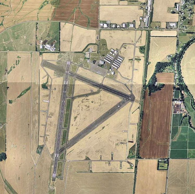
The airport covers 1,490 acres (603 ha) at an elevation of 250 feet (76 m). It has two asphalt runways: 17/35 is 5,900 by 150 feet (1,798 x 46 m) and 9/27 is 3,545 by 75 feet (1,081 x 23 m).
In the year ending February 18, 2010 the airport had 52,300 aircraft operations, average 143 per day: 97.5% general aviation, 1.5% military, and 1% air taxi. 153 aircraft were then based at this airport: 80% single-engine, 8% multi-engine, 1% jet, and 11% helicopter.