
Country United States Time zone Eastern (EST) (UTC-5) FIPS code 36-18388 Elevation 344 m Population 19,059 (2013) | County Cortland Area code(s) 607 GNIS feature ID 0947499 Zip code 13045 | |
 | ||
Weather 9°C, Wind E at 5 km/h, 35% Humidity University | ||
Cortland is a city in Cortland County, New York, United States of America. Cortland is in New York's Southern Tier region. As of the 2010 census, the city had a population of 19,204. It is the county seat of Cortland County.
Contents
- Map of Cortland NY 13045 USA
- History
- Notable people
- Geography
- Roads and highways
- Bus
- Air
- Demographics
- Government
- Sports
- References
Map of Cortland, NY 13045, USA
The city of Cortland, near the west border of the county, is surrounded by the town of Cortlandville.
History
The city is within the former Central New York Military Tract. The city is named after Pierre Van Cortlandt, the first lieutenant governor of the state of New York.
Cortland, settled in 1791, was made a village in 1853 (rechartered in 1864), and was incorporated as a city in 1900 as the 41st city in New York state. When the county was formed in 1808, Cortland vied with other villages and won the status of becoming the county seat. Known as the "Crown City" because of its location on a plain formed by the convergence of seven valleys, Cortland is situated at 1,130 feet (340 m) above sea level. Forty stars representing the 40 cities incorporated before Cortland circle the State of New York and Crown on the city's official seal. The seven points of the crown create seven valleys depicting Cortland's seven surrounding valleys. The 41st star in the center of the crown illustrates Cortland as the closest incorporated city to the geographic center of New York.
The leading industry in Cortland in the late nineteenth and early twentieth century was the Wickwire Brothers wire drawing mill, noted for its production of wire hardware cloth for use as window screens. The extent of their wealth is commemorated in a pair of magnificent mansions. The Victorian Chateauesque style home of Chester Wickwire is now the 1890 House Museum & Center for Victorian Arts, while the 1912 home of Charles Wickwire is now owned and operated by the SUNY Cortland Alumni Association. It is open to the public as well as being used by the Alumni Association to host college-related events and house visiting dignitaries.
Cortland was also home to Brockway Motor Company, a pioneering truck maker. Begun in 1875 as Brockway Carriage Works, it was taken over by Mack Trucks in 1956, and survived until 1977. The city continues to host an annual show of Brockway trucks.
Cortland also boasts a classic octagon house and the still-operating, garden-type Cortland Rural Cemetery.
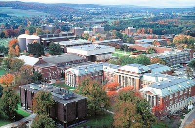
In 1868 Cortland became the home of the Cortland Normal School, now the State University of New York at Cortland.
From 1960 to 1992, Smith Corona typewriters were manufactured in Cortland.
In 2006, Cortland's historic clock tower burned down. It was later re-built, with spaces for both businesses and apartment style housing.
The Cortland County Courthouse, Cortland County Poor Farm, Cortland Fire Headquarters, Cortland Free Library, First Presbyterian Church Complex, William J. Greenman House, Randall Farm, Tompkins Street Historic District, Unitarian Universalist Church, and United States Post Office are listed on the National Register of Historic Places.
Notable people
John Eaton- Mayor of Cuyler
Geography
Cortland is located in west-central Cortland County at 42°36′2″N 76°10′53″W (42.600658, −76.181284). Cortland lies between Syracuse, New York and Binghamton, New York. It is surrounded by the town of Cortlandville.
According to the United States Census Bureau, the city has a total area of 3.92 square miles (10.14 km2), of which 3.90 square miles (10.09 km2) is land and 0.02 square miles (0.05 km2), or 0.51%, is water.
The Tioughnioga River, a tributary of the Susquehanna River, flows southward past the city.
Roads and highways
Interstate 81, U.S. Route 11, and New York State Route 281 are north-south highways servicing the city. New York State Route 13 and New York State Route 41 also serve the city. Via I-81 it is 40 miles (64 km) north to Syracuse and 40 miles (64 km) south to Binghamton. NY-13 leads southwest 18 miles (29 km) to Ithaca.
Bus
Local public transportation by bus is provided by Cortland Transit. Greyhound provides the city with intercity bus service with connections to Syracuse, Binghamton, and points beyond. The closest Amtrak train station is in Syracuse.
Air
Air service is provided by Cortland County Airport located west of the city.
Demographics
As of the census of 2000, there were 18,740 people, 6,922 households, and 3,454 families residing in the city. The population density was 4,778.6 people per square mile (1,845.8/km²). There were 7,550 housing units at an average density of 1,925.2 per square mile (743.6/km²). The racial makeup of the city was 95.72% White, 1.56% African American, 0.25% Native American, 0.57% Asian, 0.02% Pacific Islander, 0.56% from other races, and 1.33% from two or more races. Hispanic or Latino of any race were 1.72% of the population.
There were 6,922 households out of which 24.8% had children under the age of 18 living with them, 34.7% were married couples living together, 11.4% had a female householder with no husband present, and 50.1% were non-families. 36.0% of all households were made up of individuals and 13.0% had someone living alone who was 65 years of age or older. The average household size was 2.28 and the average family size was 2.95.
In the city, the population was spread out with 18.3% under the age of 18, 28.4% from 18 to 24, 23.6% from 25 to 44, 16.8% from 45 to 64, and 12.9% who were 65 years of age or older. The median age was 28 years. For every 100 females there were 88.4 males. For every 100 females age 18 and over, there were 84.5 males.
The median income for a household in the city was $26,478, and the median income for a family was $39,167. Males had a median income of $29,857 versus $21,614 for females. The per capita income for the city was $14,267. About 13.9% of families and 24.7% of the population were below the poverty line, including 24.8% of those under age 18 and 15.2% of those age 65 or over.
As of 2015 the largest self-reported ancestry groups in Cortland, New York were:
Government
The government of Cortland consists of a mayor, who is elected at large, and a city council consisting of eight members. One member is elected from each of the eight voting wards.
Sports
In summer 2009, the New York Jets training camp was moved to Cortland from its traditional home at Hofstra University in Hempstead. The team located their operations at the State University of New York, Cortland campus. The camp drew in 34,000 visitors and brought nearly $4.26 million to the local economy. In 2010, the Jets signed a 3-year contract with SUNY Cortland to continue their partnership.