
Time zone PET (UTC-5) Area 620.7 km² | Elevation 861 m | |
 | ||
Districts | ||
Aniversario de la carretera cono este la fiesta en las calles
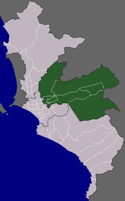
The Cono Este is one of the six areas that make up the Lima Metropolitan Area. It is located in the eastern part of the metropolis hence its name. The socioeconomic levels of its residents are varied. They mainly belong however to the middle class. Wealthier residents can be found in a few districts in this area as many Limeans move to this area to escape the cloudy winters of Lima. During the winter, this is the only area of Lima that is not permanently covered by fog. The most developed areas of this section are the urbanizations of Chosica and Chaclacayo. These areas are home to picturesque winter housing developments owned by Limeans seeking to escape the winter fog. The least developed are that of El Agustino which is populated by slum housing, and Cienguilla, which is mostly unurbanized. The district of Ate has to some extent undergone industrialization with several factories having been built there.
Contents
- Aniversario de la carretera cono este la fiesta en las calles
- Sta u clara vitarte cono este
- Districts
- References
Sta u clara vitarte cono este
Districts
The following districts are part of the Cono Este: