
Existed: 1932 – present Constructed 1932 | Length 16.75 km | |
 | ||
County | ||
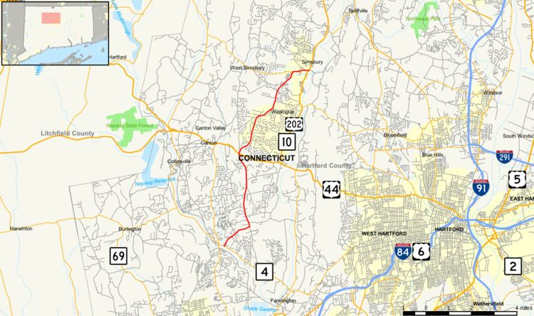
Route 167 is a Connecticut state highway in the western suburbs of Hartford, running from the Unionville section of Farmington to Simsbury center.
Contents
Map of CT-167, Connecticut, USA
Route description
Route 167 begins as West Avon Road at an intersection with Route 4 in the Unionville section of the town of Farmington. It proceeds in a northeast direction, crossing into the town of Avon after 0.7 miles (1.1 km). In Avon, it continues north through the West Avon section of town for about 3.4 miles (5.5 km) before entering the town of Simsbury. The road name changes to Bushy Hill Road after crossing the town line, where it also has a junction with US 44 and US 202. Route 167 continues generally northeast for 4.8 miles (7.7 km), then meets Route 309 (leading to West Simsbury village). Here, Route 167 turns east onto West Street and continues for another 0.7 miles (1.1 km) before ending at an intersection with US 202 and Route 10 in Simsbury Center.
A section of Route 167 from Harris Road in Avon to the Simsbury-Avon town line is designated the First Company Governor’s Horse Guards Memorial Highway.
History
Route 167 was establilshed as part of the 1932 state highway renumbering from previously unnumbered roads and has no major changes since.
Junction list
The entire route is in Hartford County.