
Named 1670 Elevation 71 m Local time Wednesday 4:09 AM | Region Capitol Region Time zone Eastern (UTC-5) Founded 1670 Population 23,511 (2010) | |
 | ||
Weather 0°C, Wind W at 16 km/h, 68% Humidity | ||
Simsbury is a suburban town in Hartford County, Connecticut, United States. The population was 23,513 at the 2010 census. The town was incorporated as Connecticut's twenty-first town in May 1670. Simsbury was named the 4th best town in Connecticut on Connecticut Magazines list of top places to live 2013 and 9th best town to live in 2015 in the United States by Time magazine.
Contents
- Map of Simsbury CT USA
- Early history
- Incorporation
- King Philips War
- Daniel Hayes
- First American colonies coins
- Geography
- Principal communities
- Demographics
- Top employers
- Landmarks
- On the National Register of Historic Places
- Skaters
- Others
- Public safety
- Simsbury Public Library
- Public high schools
- Private high schools
- Public primarymiddle schools
- Private primarymiddle schools
- Sister cities
- References
Map of Simsbury, CT, USA
Simsbury boasts a highly recognized educational system. In 2016 Simsbury High School ranked 4th best high school in CT by Niche and 9th by U.S. News & World Report. The suburb also houses multiple private schools including The Ethel Walker School, Westminster School, The Master's School, St. Mary's Elementary School, and The Cobb Montessori School.
Simsbury built the Simsbury Meadows Performing Arts Center in 2005.
Early history
At the beginning of the 17th century, the area today known as Simsbury was inhabited by indigenous peoples. The Wappinger were one of these groups, composed of eighteen bands, organized not as formally as a tribe, but more of an association, like the Delaware. These bands lived between the Hudson and Connecticut rivers. The Wappingers were one of the Algonquian peoples, a linguistic grouping which includes hundreds of tribes. One of the Wappinger bands, the Massaco, lived near, but mostly west of what is now called the Farmington River, the area now known as Simsbury and Canton. The river was called the Massaco by the native inhabitants. The term Massaco may refer to the indigenous peoples, the river itself, the village occupied by the indigenous peoples, and the land adjacent to the river.
In 1633, Windsor was the second town in Connecticut settled by Europeans and the first English settlement (the first European settlement being Huys de Goede Hoop, established by the Dutch in the Hartford area as a frontier settlement for the New Netherland Colony ten years earlier). For some time, the area of Massaco was considered "an appendix to the towne of Windsor." Settlers in Windsor forested and farmed in the area, but did not come to Massaco permanently for a number of years. In 1642, the General Court [of the colony of Connecticut] ordered that:
the Governor and Mr. Heynes shall have liberty to dispose of the ground uppon that parte of Tunxis River cauled Mossocowe, to such inhabitants of Wyndsor as they shall see cause.
Despite this order, there is no record that any settlements ensued immediately. Five years later the General Court issued another order:
The Court thinks fitt that Massacoe be purchased by the Country, and that ther be a Comitte chosen to dispose of yt to such inhabitants of Wyndsor as by the shalbe judged meet to make improuement therof...
but there is no record of grants of land arising from this order.
In 1643, John Griffin and Michael Humphrey started a tar and turpentine business in Windsor. A few years later, a Massaco Indian named Manahanoose started a fire which destroyed tar belonging to Griffin. The Court ordered the payment of "five hundred fathom of wampum" as compensation. Instead of cash payment, Manahanoose delivered a deed to the land at Massacoe. The deed was agreed to by Manahanoose as well as other Indians, identified as "the proprietors of Massaco". In 1653, the General Court granted 50 acres (200,000 m2) of meadowland to Lieutenant Aaron Cook, 60 acres (240,000 m2) to John Bissell and 50 acres (200,000 m2) to Thomas Ford, all in Massacoe.
White settlers were farming the land and harvesting tar and turpentine in the 1650s, but did not build permanent settlements until the following decade. Aaron Cook built one of the early homes in the area now known as Terry's Plain, and John Griffin built a home, possibly in 1664, the date associated with a deed to land in Massacoe. The settlement of Massacoe continued in the late 1660s. The General Court awarded a land grant to John Griffin of two hundred acres in 1663. In 1664, a deed description indicated he had become a permanent inhabitant. By 1669, a survey revealed that there were thirteen permanent residents of Massacoe. One of those residents, John Case, was appointed to the position of constable. This is the first recorded civil office held by residents of the area.
Incorporation
In 1670, Case, along with Joshua Holcomb & Thomas Barber, presented a petition to the General Court, requesting that Massacoe become a town of the colony of Connecticut. On May 12 of 1670, the General Court granted the petition, and ordered that the plantation should be called "Simmsbury". The boundaries at that time were Farmington on the south and Windsor on the east, with the extent of Simsbury running 10 miles (16 km) north of Farmington and 10 miles west of Windsor, although the northern border, subject to dispute with Massachusetts, would be resolved later. This extent covers what is present-day Simsbury as well as Granby and Canton.
The precise origin of the name of the town is not known for certain. The town records covering the first ten years after incorporation were accidentally burned in 1680 and 1681. One possibility is that the name of Simsbury comes from the English town of Symondsbury. Holcomb, one of the petitioners, originally came from Symondsbury. Another possibility is that the name was derived from Simon Wolcott. He was known familiarly as "Sim", and he was considered one of the prominent men of the town.
King Philip's War
In 1675, rumors of unrest among the indigenous peoples began to surface. The rumors proved accurate, and in the summer, King Philip's War began, a war between a number of tribes and the English settlers. The war extended through parts of four colonies, with Simsbury on the western edge of the conflict. At the time, it was seen as a frontier settlement. The conflict was largely over by August 1676, although it did not formally end until a treaty was signed in 1678.
The colony formed a Council of War. In the days leading up to the war, they ordered settlers to keep night watches, and to work in the fields in armed groups of at least six. By the time of the colony's General Court meeting of October 14, 1675, the situation was considered serious enough that the court ordered the residents of Simsbury to move to safety in Windsor. The order read:
This Court orders, that the people of Simsbury shall have a week's time to secure themselves and their corn there, and at the end of the week from this date, the souldiers, now in garrison at Simsbury, shall be released their attendance there.
In March 1676, the town of Simsbury was first pillaged, then burned to the ground. This destruction is described as the most extensive of any event of any Indian War in New England. The settlers remained in Windsor until the spring of 1677, at which time most moved back to Simsbury, although some never returned.
Daniel Hayes
In 1707, Daniel Hayes, then aged twenty-two, was captured by the indigenous people and carried off to Canada. The capture was witnessed, and a rescue party raised, but the group did not catch up with the captors. He was tied up each night, and bound to saplings. It took thirty days to reach Canada, at which point Hayes was forced to run the gauntlet. Near the end of the gauntlet, he hid in a wigwam to avoid an attempted blow by a club. The woman in the wigwam declared that the house was sacred, and having lost a husband and son to a war, adopted Hayes as her son. He remained for several years, attending to the woman. Eventually, he was sold to a Frenchman, who learned that Hayes had skill as a weaver, so put him to work in that business. Hayes managed to earn enough to buy his freedom after two years. He then returned to Simsbury, settled down on a farm and married. He became prominent, both in civil affairs as well as the church at Salmon Brook (now Granby).
First American colonies coins
The first unauthorized coins minted in the American colonies, and the first in Connecticut, were struck by Dr. Samuel Higley in 1737 from copper mined from his own mine. The coins, including the Trader's Currency Token of the Colony of Connecticut, were minted in North Simsbury, now called Granby. These coins were made of pure copper, which is very soft. Consequently, there are very few in existence today. The first coins were inscribed with a value of three pence. Later versions carried the phrase "Value me as you please."
Geography
According to the United States Census Bureau, the town has a total area of 34.3 square miles (88.8 km2), of which 33.9 square miles (87.9 km2) is land and 0.39 square miles (1.0 km2), or 1.09%, is water.
Simsbury lies in the northern end of the Farmington Valley. The east side of Simsbury is flanked by Talcott Mountain, part of the Metacomet Ridge, a mountainous trap rock ridgeline that stretches from Long Island Sound to nearly the Vermont border. Notable features of the Metacomet Ridge in Simsbury include Heublein Tower, Talcott Mountain State Park, Penwood State Park, and the Tariffville Gorge of the Farmington River. The 51-mile-long (82 km) Metacomet Trail traverses the ridge. At the western foot of the mountain, near the Farmington River, grows the Pinchot Sycamore, the largest tree in Connecticut.
Simsbury is roughly equidistant from both New York City (around 90 miles SW) and Boston, Massachusetts (around 90 miles ENE). The town is often considered a bedroom community for the nearby city of Hartford, Connecticut, a 35 to 40 minute drive from Simsbury Center, however many residents also commute to other towns and cities within the west-central Connecticut region.
Principal communities
There are four census-designated places in Simsbury: Simsbury Center, Tariffville, Weatogue, and West Simsbury.
Demographics
As of the census of 2000, there were 23,234 people, 8,527 households, and 6,591 families residing in the town. The population density was 685.7 people per square mile (264.8/km²). There were 8,739 housing units at an average density of 257.9 per square mile (99.6/km²). The racial makeup of the town was 95.3% White, 1.17% African American, 0.09% Native American, 2.12% Asian, 0.03% Pacific Islander, 0.26% from other races, and 1.03% from two or more races. Hispanic or Latino of any race were 1.54% of the population. The ethnic make-up of the town in terms of percentage of total residents (the five most common, ordered from most-reported to least) is Irish (23.0%), English (17.4%), German (15.6%), Italian (13.7%), and Polish (7.6%).
There were 8,527 households out of which 41.1% had children under the age of 18 living with them, 69.1% were married couples living together, 6.4% had a female householder with no husband present, and 22.7% were non-families. 19.4% of all households were made up of individuals and 7.8% had someone living alone who was 65 years of age or older. The average household size was 2.70 and the average family size was 3.12.
In the town, the population was spread out with 29.5% under the age of 18, 3.6% from 18 to 24, 27.7% from 25 to 44, 26.6% from 45 to 64, and 12.5% who were 65 years of age or older. The median age was 40 years. For every 100 females there were 94.6 males. For every 100 females age 18 and over, there were 89.3 males.
The median income for a household in the town was $120,432, and the median income for a family was $155,769 (as of a 2011estimate). Males had a median income of $89,519 versus $42,136 for females. The per capita income for the town was $54,711. About 1.0% of families and 2.2% of the population were below the poverty line, including 1.6% of those under age 18 and 4.3% of those age 65 or over.
Top employers
According to Simsbury's 2011 Comprehensive Annual Financial Report, the top employers in the city are:
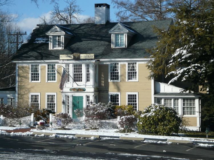
Landmarks
On the National Register of Historic Places
Skaters
Others
Public safety
Law enforcement is provided by the Simsbury Police Department.
Fire protection is provided by the Simsbury Volunteer Fire Company. The Fire Company has six stations located throughout the town and a dispatch center housed at the Main Station. The Fire Company has seven engines, two aerials, two rescues, a tanker, two marine units, a hazmat unit, a brush truck, a special command vehicle and several utility vehicles. In addition to fire suppression and vehicle extrication, the Fire Company provides high-angle, confined-space and ice rescue services, and is a member of the Capital Region HazMat Response Team.
Emergency medical services are provided by the Simsbury Volunteer Ambulance Association. The Association has a primary ambulance staffed twenty-four hours a day by volunteer EMTs. There is a secondary ambulance that is staffed with paid personnel during peak hours and can also be staffed by off-duty personnel for calls when the primary ambulance is out. SVAA also has a paramedic response unit staffed around the clock by a career paramedic, providing the residents of Simsbury with the highest level of emergency medical care. The organization has 8 paramedics and 43 active EMTs. In addition to being the primary EMS responder in town, SVAA also does stand-bys at public events and holds first aid/CPR courses throughout the year, as well as an annual EMT-Basic course.
Simsbury Public Library
The Simsbury Public Library serves more than 800 residents daily and offers many programs and services including homebound delivery, public computers, a museum pass program, a Business Resource Center, and 24/7 reference assistance. The library can trace its history back to 1872 as the Town’s Social and Literary Club. In 1890 the town built a library as part of the Town’s center and it operated until the present library was constructed nearby in 1985. The library held a grand opening to celebrate the renovated library in June 2008. In the year ending June 30, 2006, the library maintained a collection of 163,000 print, audio, and video items, offered the contents of 40 databases, circulated 436,000 items, answered 57,000 requests for information, and offered 756 programs to the various constituencies that the Library serves.
In the last five years, the Simsbury Public Library has ranked among the top five of Connecticut's public libraries according to Hennen's American Public Library Ratings. In 2002, it ranked among the top 100 in the country (out of 9,000). In 2008 the Simsbury Public Library expanded with a new addition.
Public high schools
Private high schools
Public primary/middle schools
& Homebound (Location: 933 Hopmeadow Street; Grades: PK – 12)