
Founded 1846 Area 2,062 km² | Website www.co.columbia.wi.us Population 56,653 (2013) Unemployment rate 4.2% (Apr 2015) | |
 | ||
Points of interest Cascade Mountain, Wizard Quest, Ripley's Believe It Or Not, Bowman Park, Gibraltar Rock State Natural A Destinations | ||
Columbia County is a county located in the U.S. state of Wisconsin. As of the 2010 census, the population was 56,833. Its county seat and largest city is Portage. The county was created in 1846. At the time, it was in the Wisconsin Territory.
Contents
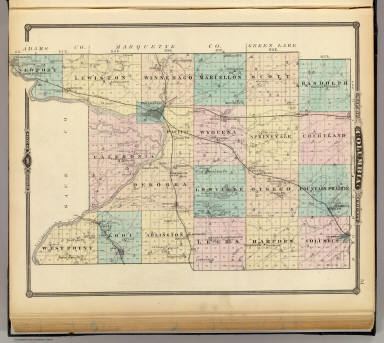
- Map of Columbia County WI USA
- Geography
- Airports
- Adjacent counties
- Demographics
- Cities
- Census designated places
- Ghost town
- References
Map of Columbia County, WI, USA
Columbia County is part of the Madison, WI Metropolitan Statistical Area as well as the Madison-Janesville-Beloit, WI Combined Statistical Area.
Geography
According to the U.S. Census Bureau, the county has a total area of 796 square miles (2,060 km2), of which 766 square miles (1,980 km2) is land and 30 square miles (78 km2) (3.8%) is water. The county's highest point is Gibraltar Rock at 1,247 feet above sea level. The high butte-shaped bluff is located north of Lodi overlooking the Lake Wisconsin River valley.
Airports
Adjacent counties
Demographics
As of the census of 2000, there were 52,468 people, 20,439 households, and 14,164 families residing in the county. The population density was 68 people per square mile (26/km²). There were 22,685 housing units at an average density of 29 per square mile (11/km²). The racial makeup of the county was 97.18% White, 0.88% Black or African American, 0.35% Native American, 0.33% Asian, 0.02% Pacific Islander, 0.44% from other races, and 0.79% from two or more races. 1.58% of the population were Hispanic or Latino of any race. 46.4% were of German, 10.2% Norwegian, 7.8% Irish, 6.4% English and 5.0% United States or American ancestry.
There were 20,439 households out of which 32.20% had children under the age of 18 living with them, 58.10% were married couples living together, 7.40% had a female householder with no husband present, and 30.70% were non-families. 25.50% of all households were made up of individuals and 11.00% had someone living alone who was 65 years of age or older. The average household size was 2.49 and the average family size was 2.99.
In the county, the population was spread out with 25.20% under the age of 18, 7.10% from 18 to 24, 29.90% from 25 to 44, 23.40% from 45 to 64, and 14.40% who were 65 years of age or older. The median age was 38 years. For every 100 females there were 101.60 males. For every 100 females age 18 and over, there were 100.40 males.