
Area 1,202 km² Population 15,176 (2013) | Website www.co.marquette.wi.us Founded 1836 | |
 | ||
Points of interest | ||
Marquette County is a county located in the U.S. state of Wisconsin. As of the 2010 census, the population was 15,404. Its county seat is Montello. The county was created in 1836 from the Wisconsin Territory and organized in 1848.
Contents
- Map of Marquette County WI USA
- Geography
- Major highways
- Adjacent counties
- National protected area
- Demographics
- City
- Villages
- Census designated place
- References
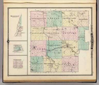
Map of Marquette County, WI, USA
Geography
According to the U.S. Census Bureau, the county has a total area of 464 square miles (1,200 km2), of which 456 square miles (1,180 km2) is land and 8.7 square miles (23 km2) (1.9%) is water. The Mecan River, Buffalo Lake, and Puckaway Lake lie within Marquette County. The highest altitude in the county is a rocky area known as Mt. Shaw.
Major highways
Adjacent counties
National protected area
Demographics
As of the census of 2000, there were 15,832 people, 5,986 households, and 4,166 families residing in the county. The population density was 35 people per square mile (13/km²). There were 8,664 housing units at an average density of 19 per square mile (7/km²). The racial makeup of the county was 93.66% White, 3.44% Black or African American, 1.04% Native American, 0.27% Asian, 0.10% Pacific Islander, 0.38% from other races, and 1.11% from two or more races. 2.66% of the population were Hispanic or Latino of any race. 45.7% were of German, 8.2% Irish, 6.9% Polish, 6.1% English, 5.6% Norwegian and 5.1% American ancestry according to Census 2000. 94.8% spoke English, 2.8% Spanish and 1.1% German as their first language.
There were 5,986 households out of which 26.90% had children under the age of 18 living with them, 58.70% were married couples living together, 6.70% had a female householder with no husband present, and 30.40% were non-families. 25.40% of all households were made up of individuals and 12.30% had someone living alone who was 65 years of age or older. The average household size was 2.41 and the average family size was 2.86.
In the county, the population was spread out with 21.10% under the age of 18, 6.70% from 18 to 24, 28.90% from 25 to 44, 25.00% from 45 to 64, and 18.30% who were 65 years of age or older. The median age was 41 years. For every 100 females there were 118.90 males. For every 100 females age 18 and over, there were 123.70 males.