
Founded January 16, 1854 Area 1,782 km² | Website www.co.columbia.or.us Population 49,344 (2013) Unemployment rate 6.6% (Apr 2015) | |
 | ||
Destinations | ||
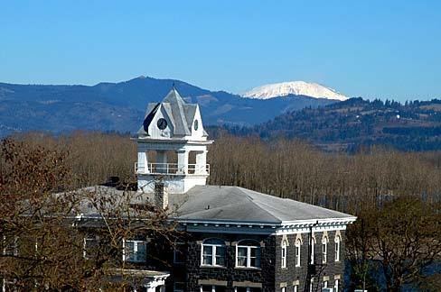
Beaver falls columbia county oregon part 1
Columbia County is a county in the U.S. state of Oregon. As of the 2010 census, the population was 49,351. The county seat is St. Helens. It was named for the Columbia River, which forms its eastern and northern borders.
Contents
- Beaver falls columbia county oregon part 1
- Map of Columbia County OR USA
- Beaver falls columbia county oregon part 2
- History
- Geography
- Adjacent counties
- National protected area
- 2000 census
- 2010 census
- Government
- Politics
- Economy
- Transportation
- Cities
- Census designated places
- References
Map of Columbia County, OR, USA
Columbia County is part of the Portland-Vancouver-Hillsboro, OR-WA Portland metropolitan area and is located in Northwest Oregon.
Beaver falls columbia county oregon part 2
History
The Chinook and Clatskanie Native Americans inhabited this region for centuries prior to the arrival of Robert Gray, captain of the ship Columbia Rediviva, in 1792. The Lewis and Clark Expedition traveled and camped along the Columbia River shore in the area later known as Columbia County in late 1805 and on their return journey in early 1806.
Columbia County was created in 1854 from the northern half of Washington County. Milton served as the county seat until 1857 when it was moved to St. Helens.
Columbia County has been afflicted by numerous flooding disasters, the most recent in December 2007. Heavy rains caused the Nehalem River to escape its banks and flood the city of Vernonia and rural areas nearby. Columbia County received a presidential disaster declaration for this event.
Geography
According to the U.S. Census Bureau, the county has an area of 688 square miles (1,780 km2), of which 657 square miles (1,700 km2) is land and 31 square miles (80 km2) (4.5%) is water. It is Oregon's third-smallest county by land area and fourth-smallest by total area.
Adjacent counties
National protected area
2000 census
As of the census of 2000, there were 43,560 people, 16,375 households, and 12,035 families residing in the county. The population density was 66 people per square mile (26/km²). There were 17,572 housing units at an average density of 27 per square mile (10/km²). The racial makeup of the county was 94.42% White, 0.24% Black or African American, 1.33% Native American, 0.59% Asian, 0.10% Pacific Islander, 0.79% from other races, and 2.53% from two or more races. 2.51% of the population were Hispanic or Latino of any race. 21.2% were of German, 10.8% English, 9.4% American, 9.3% Irish and 5.4% Norwegian ancestry.
There were 16,375 households out of which 34.40% had children under the age of 18 living with them, 60.50% were married couples living together, 8.70% had a female householder with no husband present, and 26.50% were non-families. 21.10% of all households were made up of individuals and 8.10% had someone living alone who was 65 years of age or older. The average household size was 2.65 and the average family size was 3.06.
In the county, the population was spread out with 27.30% under the age of 18, 7.00% from 18 to 24, 28.10% from 25 to 44, 26.00% from 45 to 64, and 11.60% who were 65 years of age or older. The median age was 38 years. For every 100 females there were 100.00 males. For every 100 females age 18 and over, there were 98.10 males.
The median income for a household in the county was $45,797, and the median income for a family was $51,381. Males had a median income of $42,227 versus $27,216 for females. The per capita income for the county was $20,078. About 6.70% of families and 9.10% of the population were below the poverty line, including 11.60% of those under age 18 and 7.00% of those age 65 or over.
2010 census
As of the 2010 United States Census, there were 49,351 people, 19,183 households, and 13,516 families residing in the county. The population density was 75.1 inhabitants per square mile (29.0/km2). There were 20,698 housing units at an average density of 31.5 per square mile (12.2/km2). The racial makeup of the county was 92.5% white, 1.3% American Indian, 0.9% Asian, 0.4% black or African American, 0.2% Pacific islander, 1.2% from other races, and 3.4% from two or more races. Those of Hispanic or Latino origin made up 4.0% of the population. In terms of ancestry, 26.1% were German, 14.5% were English, 14.4% were Irish, 5.9% were Norwegian, and 4.8% were American.
Of the 19,183 households, 32.0% had children under the age of 18 living with them, 55.5% were married couples living together, 9.8% had a female householder with no husband present, 29.5% were non-families, and 23.3% of all households were made up of individuals. The average household size was 2.55 and the average family size was 2.98. The median age was 41.3 years.
The median income for a household in the county was $55,199 and the median income for a family was $62,728. Males had a median income of $52,989 versus $35,558 for females. The per capita income for the county was $24,613. About 6.5% of families and 10.3% of the population were below the poverty line, including 12.7% of those under age 18 and 6.6% of those age 65 or over.
Government
The county is governed by an elected board of three commissioners. Each commissioner is elected to a term of four years. Other elected officials include the sheriff, county clerk, district attorney, treasurer, surveyor, assessor and justice of the peace.
Politics
In Presidential elections the county was between 1930 and 2010 among the most consistently Democratic in Oregon. The last Republican to win a majority in Columbia County had been Herbert Hoover in the 1928 presidential election, although before 1930 no Democrat had won a majority in the county since Samuel J. Tilden in 1876. However in 2016 Donald Trump won the county with just under fifty percent of the vote ending the tradition of choosing Democrats for president. That stated, the margin had been as little as three percent in 2004 and in 1984.
Columbia County is part of Oregon's 1st congressional district, which is represented by Suzanne Bonamici and has a Cook Partisan Voting Index score of D+8.
Economy
The primary industries are wood products and paper manufacturing, trade, construction and horticulture. The extensive stands of old growth timber, which had attracted many of the early settlers to the area, were completely logged over by the 1950s. Second-growth timber provides the raw material for local lumber and paper mills. About half the county's workforce commutes out of the county to work, most to the nearby Portland, Oregon metro area. Columbia County's average nonfarm employment was 10,740 in 2007. The five largest private employers in Columbia County are Fred Meyer, Armstrong World Industries, Wal-Mart, Boise Paper, USIA, and USG.
Transportation
Limited public transit service within Columbia County, and connecting the county with certain points in adjacent counties, is provided by the Columbia County Rider (or CC Rider), a service operated by the county's Transit Division. The service carried 91,500 passengers in 2010.