
Length 137.7 km | ||
 | ||
Counties | ||
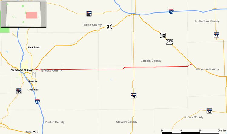
State Highway 94 is an 85.5-mile-long (137.6 km) east–west Colorado state highway that goes east beginning from US 24 just east of Colorado Springs and ending at U.S. Highway 40/U.S. Highway 287 in rural Cheyenne County west of Wild Horse. The highway serves Schriever Air Force Base and the towns of Ellicott, Yoder, and Rush, where it then crosses through rural country. It also serves the Punkin Center area where it comes to a junction with SH 71. It then passes through more very rural country until it reaches a stop at US 40/287 west of the unincorporated town of Wild Horse.
Contents
Map of CO-94, Colorado, USA
Throughout most of its length, the highway runs due east–west, pointing exactly at Pikes Peak. Under good conditions, the peak can be seen as far east as the rise between mileposts 78 and 79.
"Garbage Hill" gets its name from the Colorado Springs landfill located north of the highway. Originally, the entrance to the landfill was partway up the hill, but currently the entrance is from Blaney Road at the top of the hill. At the bottom of the hill, which is the eastern side of Jimmy Camp Creek valley, there are wrecking yards and two motocross tracks. This hill is one of the most severe hills on Highway 94, having a climbing lane.
History
The route was established in the 1920s, with the eastern end swerving north then east, ending at Boyero. By 1954, the eastern end no longer swerved north, and by 1970 the eastern end was extended to US 40/287 near Aroya with the entire highway paved.