
Length 41 km | ||
 | ||
County | ||
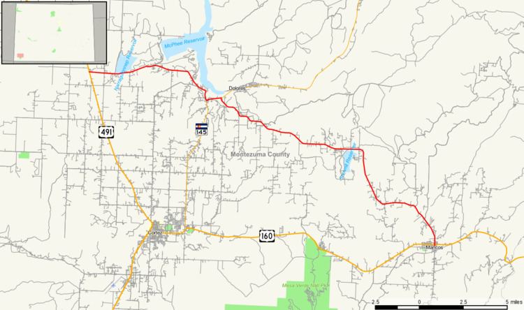
State Highway 184 (SH 184) is a 25.5 mi (41.0 km) long state highway in the southwestern corner of Colorado.
Contents
Map of CO-184, Colorado, USA
Route description
SH 184 begins in the west at its junction with US 491 near Lewis and travels ESE to Mancos. The highway has a one mile (1.6 km) overlap with State Highway 145 just south of Dolores which is not technically part of SH 184 making the actual driving distance from Lewis to Mancos just over 26.5 miles (42.6 km). It also intersects US 160 near Mancos, near its eastern terminus at US 160 Bus.
History
The route was established in 1939, when it connected U.S. Highway 160 at Arriola to Mancos. Most of the route was deleted by 1954, leaving approximately nine miles near Mancos. The route was extended to Dolores by 1978, when it was entirely paved.
Major intersections
The entire route is in Montezuma County.