
Length 46.2 km | ||
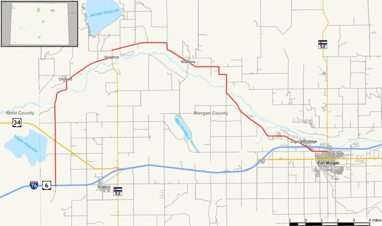 | ||
State Highway 144 is a 28.7 mi (46.2 km) long state highway in northeastern Colorado.
Contents
Map of CO-144, Colorado, USA
Route description
SH 144 begins in the west at Interstate 76 and proceeds initially to the north; after 2.8 mi (4.5 km), the road crosses U.S. Highway 34. After another 3.8 mi (6.1 km), the route crosses the South Platte River and begins to curve in a broad arc to the east roughly following a meander of the South Platte. Continuing now in a generally westward direction, SH 144 meets the north end of State Highway 39 at Goodrich. The road then continues its arc westward and eventually WSW through Weldona, again across the South Platte River, and through Log Lane Village. Now traveling in approximately a southwesterly direction, SH 144 crosses to the south side of Interstate 76 and continues for a further 1.4 mi (2.3 km) to its eastern terminus at State Highway 52 in Fort Morgan.
Major intersections
The entire route is in Morgan County.