
County Morgan Time zone MST (UTC-7) Elevation 1,297 m Population 11,407 (2013) | Incorporated June 15, 1887 ZIP codes 80701 & 80705 Local time Tuesday 9:32 PM | |
 | ||
Weather 8°C, Wind SE at 11 km/h, 43% Humidity | ||
Fort Morgan is the Home Rule Municipality that is the county seat and the most populous municipality of Morgan County, Colorado, United States. The United States Census Bureau estimated that the city population was 10,844 in 2005.
Contents
- Map of Fort Morgan CO 80701 USA
- History
- Town
- Demographics
- Economy
- Transportation
- Major Highways
- Media
- Notable people
- References
Map of Fort Morgan, CO 80701, USA
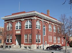
History
Camp Wardwell was established in 1865 along the Overland Trail to protect emigrants and supplies going to and from Denver and the mining districts. The fort was renamed in 1866 by General John Pope for one of his staff, Colonel Christopher A. Morgan, who had died earlier that year. The fort closed in 1868 after being used by 19 different companies from 11 cavalry and infantry regiments(~1,300 soldiers).
Town
The town of Fort Morgan was platted just south of the old military fort’s ruins on May 1, 1884 by Abner S. Baker, a member of Greeley's Union Colony. The town became the county seat of the newly formed Morgan County on February 19, 1889.
In World War II, a military school at the Fort Morgan State Armory was part of the West Coast Air Corps Training Center.
Demographics
As of the census of 2000, there were 11,034 people, 3,887 households, and 2,736 families residing in the city. The population density was 2,472.1 people per square mile (955.2/km²). There were 4,094 housing units at an average density of 917.2 per square mile (354.4/km²). The racial makeup of the city was 74.43% White, 0.28% African American, 1.01% Native American, 0.18% Asian, 0.24% Pacific Islander, 20.62% from other races, and 3.24% from two or more races. Hispanic or Latino of any race were 39.04% of the population.
There were 3,887 households out of which 37.5% had children under the age of 18 living with them, 54.6% were married couples living together, 10.9% had a female householder with no husband present, and 29.6% were non-families. 25.6% of all households were made up of individuals and 12.6% had someone living alone who was 65 years of age or older. The average household size was 2.79 and the average family size was 3.32.
In the city the population was spread out with 30.2% under the age of 18, 9.6% from 18 to 24, 29.1% from 25 to 44, 18.1% from 45 to 64, and 13.1% who were 65 years of age or older. The median age was 32 years. For every 100 females there were 100.4 males. For every 100 females age 18 and over, there were 97.6 males.
The median income for a household in the city was $33,128, and the median income for a family was $36,134. Males had a median income of $27,667 versus $22,346 for females. The per capita income for the city was $15,024. About 8.9% of families and 12.9% of the population were below the poverty line, including 16.5% of those under age 18 and 8.6% of those age 65 or over.
Economy
Fort Morgan, for the most part, has an agricultural economy.
Cargill operates a meatpacking plant. As of 2016 many of the employees at the plant were Muslims, many from Somalia.
Transportation
Amtrak, the national passenger rail system, provides service through Fort Morgan, operating its California Zephyr daily in both directions between Chicago and Emeryville, California, across the bay from San Francisco.
Although the town is served by Fort Morgan Municipal Airport, there are no scheduled airlines operating from there. Denver International Airport is 76 miles southwest and is the closest airport to provide scheduled services.
Major Highways
Media
The city newspaper is the Fort Morgan Times.
Notable people
Fort Morgan is the burial place of Philip K. Dick, where he was interred alongside his twin sister who died in early childhood.
Fort Morgan is the boyhood home of Big Band musician Glenn Miller. Miller went to High school in Fort Morgan and was known to have once played trumpet on top of Abner S. Baker School, since destroyed in a fire and now rebuilt, which at the time was the high school campus but is now reserved for fifth and sixth graders.
Robert G. Whitehead (1916–2007) was born in Fort Morgan to a ranching family. He marketed the first-aid ointment known as "Blue Star". Some 50 million jars are sold annually. The product claims to offer relief from psoriasis, ringworm, athlete's foot and various kinds of itching.
Joel Dreessen, tight end for the Denver Broncos, grew up in Fort Morgan and attended Fort Morgan schools. He graduated from Fort Morgan High School in 2000.
Michael Crichton lived in Fort Morgan for a short time during World War II with his family when his father was drafted to serve in the war.
Sam Brunelli, football player