
Length 116 km | ||
 | ||
Counties | ||
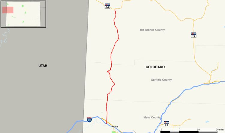
State Highway 139 (SH 139) is a 72.065-mile-long (115.977 km) state highway in western Colorado.
Contents
Map of CO-139, Colorado, USA
Route description
SH 139 begins in the south at exit 15 of Interstate 70 at Loma roughly fifteen miles west of Grand Junction. From there the road proceeds northward through very remote, very sparsely populated land to its northern end at State Highway 64 at Rangely. There are no significant settlements for the road's entire length. Near its midpoint, the road crosses Bookcliff Mountains at Douglas Pass at an elevation of 8,268 ft (2,520 m).
History
The route was established in the 1920s, when it began at U.S. Highway 6 in Loma and went north to SH 64. The route was completely deleted in 1954 and reestablished by 1964, where it ended at Douglas Pass. The route was paved from Loma to Douglas Pass in 1972, when the southern terminus was extended to Interstate 70. The route was extended back to SH 64 in 1975.