
Elevation 800 m (2,600 ft) Website Official website Population 50,256 (2015) | Department Lempira Climate Aw Area 443 km² Local time Friday 3:53 PM | |
 | ||
Founded 1536; 481 years ago (1536) Weather 23°C, Wind N at 19 km/h, 65% Humidity Points of interest Celaque National Park, El Fuerte de San Cristóbal, Casa Galeano | ||
Gracias ([ˈɡɾasjas]) is a small Honduran town/municipality that was founded in 1536, and is the capital of Lempira Department.
Contents
- Map of Gracias Honduras
- Tourism honduras gracias tours
- History
- Geography
- Transportation
- Economy
- References
Map of Gracias, Honduras
It has a population of approximately 50,000 people (12,000 in the urban center). It is found in the mountainous centre of western Honduras.
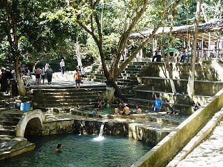
Tourism honduras gracias tours
History
The word gracias means "thanks" in Spanish. It is said that upon arriving at the site of the city of Gracias, the Spanish explorers, tired after having trekked through the mountainous terrain, said "Gracias a Dios hemos llegado a tierra plana," meaning "Thank God we have arrived at flat land."
The city was made the regional capital of the Audiencia de los Confines in 1544. However, this decision created resentment in the populated areas of Guatemala and El Salvador. In 1549, the capital was moved to Antigua, Guatemala, and Honduras remained a province within the Captaincy General of Guatemala until 1821.
Geography
Elevation ranges from roughly 800 meters at the town square to 2,870 meters at the peak of Montaña Celaque (also known as Cerro Las Minas). Climate is greatly influenced by elevation, with the low-lying portions having a wet-dry (monsoonal) pattern. Montaña Celaque is the highest mountain and largest cloud forest in Honduras, and is protected through Celaque Mountain National Park.
Transportation
Gracias serves as a transportation hub for the immediate region. The town is connected to the northern city of Santa Rosa de Copan by a paved 2 lane highway, and construction of a paved 2 lane highway to La Esperanza has been underway for several years.
Economy
Agriculture is both subsistence and export based. Agricultural crops vary with elevation and climate, with corn and beans grown at lower altitudes and fruits/vegetables grown at higher altitudes.
The development of a tourist economy is seen as a driver of economic development. This tourism is based on the town's historic and natural attractions including colonial churches, Celaque Mountain and hot springs.