
Founded 23 August 1604 Elevation 2,600 m (8,500 ft) Area 113 km² Local time Wednesday 6:54 AM | Founded by Lorenzo de Terrones Demonym(s) Coguan Population 22,361 (2015) Area code 1 | |
 | ||
Weather 11°C, Wind NE at 6 km/h, 95% Humidity | ||
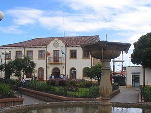
Visita a cogua cundinamarca panoramica rellena
Cogua ([ˈkoɣwa]) is a municipality and town of Colombia in the department of Cundinamarca. It is situated on northern part of the Bogotá savanna with the urban centre at an altitude of 2,600 metres (8,500 ft) at 50 kilometres (31 mi) from the capital Bogotá. Cogua borders Tausa in the north, Nemocón in the east, Pacho in the west and Zipaquirá in the south.
Contents
- Visita a cogua cundinamarca panoramica rellena
- Map of Cogua Cundinamarca Colombia
- Una nueva estaci n de ruta tr3ce en cogua cundinamarca parte 1
- Etymology
- History
- Economy
- References
Map of Cogua, Cundinamarca, Colombia
Una nueva estaci n de ruta tr3ce en cogua cundinamarca parte 1
Etymology
The name Cogua is derived from Chibcha and means "Support of the hill".
History
Cogua in the times before the Spanish conquest was inhabited by the Muisca who lived on the Altiplano Cundiboyacense and had established an advanced civilization. Cogua is located between two important sources of salt in the Muisca economy; Zipaquirá and Nemocón.
Modern Cogua was founded on August 23, 1604 by Lorenzo de Terrones.
Economy
Main economical activities of Cogua are agriculture and livestock farming. The Neusa Reservoir is located within the boundaries of Cogua.