
Elevation 4,282 m Prominence 1,320 m | Easiest route rock climb Last eruption 1150 | |
 | ||
Similar Pico de Orizaba, Malinche, Sierra Negra, Iztaccihuatl, Nevado de Toluca | ||
Cofre de Perote, originally Naupa-Tecutépetl (from Nāuhpa-Tēuctēpetl in the Nahuatl language), is known also as Nauhcampatépetl. Both Nahuatl names mean something like 'Place of Four Mountain' or 'Mountain of the Lord of Four Places'. This extinct volcano is located in the Mexican state of Veracruz, at the point where the Trans-Mexican volcanic belt, home to all of Mexico's highest peaks, joins the Sierra Madre Oriental.
Map of Cerro Cofre de Perote, Veracruz, Mexico
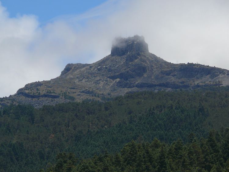
This volcano is shaped very differently from the strato-volcanic Pico de Orizaba, which lies to the south of it, being broad and shield-shaped. A cofre is a 'coffer', and the name alludes to a volcanic outcropping on the shield, which constitutes the peak of the mountain. It is outlined against the clouds in the information-box picture, and is easily visible in the picture below.
To the north of the Cofre is the town of Perote, after which the mountain is named.
Cofre de Perote is also the name of a Mexican national park where the volcano is located.
The Nauhcampatépetl is an excellent place for camping, hiking and other outdoor activities.