
Country United States of America | ||
 | ||
River mouth Confluence with Tomichi Creek7,821 ft (2,384 m) Progression Tomichi—Gunnison—Colorado | ||
Cochetopa creek
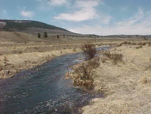
Cochetopa Creek is a stream in Saguache and Gunnison counties in Colorado, United States. It rises on San Luis Peak in the La Garita Mountains. It merges with Tomichi Creek near the town of Parlin, Colorado, along Highway 50.
Contents
Map of Cochetopa Creek, Colorado, USA
The creek flows through the Cochetopa Caldera in the San Juan volcanic field and through Cochetopa Canyon along Colorado State Highway 114.
Cochetopa creek july 6 2014 sd 480p
References
Cochetopa Creek Wikipedia(Text) CC BY-SA