
Isolation 26.9 mi (43.4 km) First ascent 1874 | Elevation 4,274 m Prominence 949 m | |
 | ||
Listing North America highest peaks 58thUS highest major peaks 44thColorado highest major peaks 24thColorado fourteeners 49th Topo map USGS 7.5' topographic mapSan Luis Peak, Colorado Easiest route South Ridge or East Flank: Hike Similar Windom Peak, Mount Eolus, Redcloud Peak, Handies Peak, Culebra Peak | ||
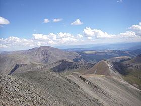
San Luis Peak is the highest summit of the La Garita Mountains range in the Rocky Mountains of North America. The prominent 14,022-foot (4273.8 m) fourteener is located in the Gunnison National Forest portion of the La Garita Wilderness in Saguache County approximately 10 miles (16 km) north of Creede. It is situated rather far to the east of the other fourteeners in the San Juans, and has more of a wilderness setting than many of the others.
Map of San Luis Peak, Colorado 81130, USA
San Luis Peak is a relatively straightforward climb, with two hiking routes to the summit, the South Ridge and the East Flank.
References
San Luis Peak Wikipedia(Text) CC BY-SA