
Length 99.3 km | ||
 | ||
Colorado state highway 114 cochetopa canyon
State Highway 114 is a 61.7 mi (99.3 km) long state highway in southern central Colorado.
Contents
- Colorado state highway 114 cochetopa canyon
- Map of CO 114 Colorado USA
- Route description
- History
- References
Map of CO-114, Colorado, USA
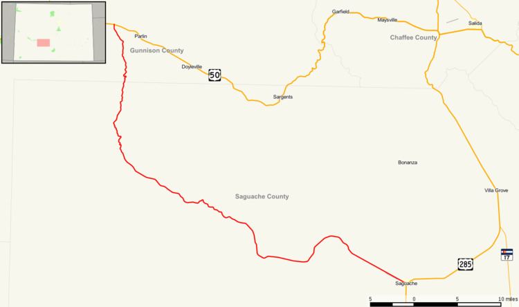
Route description
SH 114 begins in the west at its junction with U.S. Highway 50 approximately eight miles east of Gunnison. From there the route initially proceeds southward for more than twenty miles (32 km) before turning more nearly eastward and entering Gunnison National Forest and climbing up to cross the Continental Divide at North Pass at an elevation of 10,149 ft (3,093 m). At North Pass the road crosses into Rio Grande National Forest through which it passes generally eastward for roughly four and a half miles before leaving National Forest Service land and continuing for a further twenty-six miles before reaching Saguache at the northern edge of the San Luis Valley. There the road finds its eastern terminus at U.S. Highway 285.
History
The route was defined in the 1920s, using a routing over Cochetopa Pass. By 1954, the route was paved for about 12 miles (19 km) and was paved for another 8 miles (13 km) two years later. In 1963, the section over Cochetopa Pass was deleted and North Pass was used instead, paved by 1964.