
- elevation 1,370 m (4,495 ft) | - elevation 990 m (3,248 ft) | |
 | ||
- location south east of Branga Swamp - location west of Cobrabald Mountain | ||
Cobrabald river 1st descent 2008
Cobrabald River, a mostly perennial river that is part of the Namoi catchment within the Murray–Darling basin, is located in the Northern Tablelands district of New South Wales, Australia.
Contents
- Cobrabald river 1st descent 2008
- Map of Cobrabald River Walcha NSW Australia
- Copy of cobrabald river 1st descent 2008
- References
Map of Cobrabald River, Walcha NSW, Australia
The river rises in high country on the western slopes of the Great Dividing Range south east of Branga Swamp about 50 kilometres (31 mi) south of Walcha. The river flows generally north and north west for, towards its confluence with the Macdonald River; dropping 383 metres (1,257 ft) over its course of 52 kilometres (32 mi).
The entire length of the Cobrabald River is within the boundaries of Walcha Shire and Vernon County.
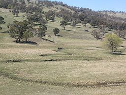
The country along the Cobrabald River is a rich grazing area used for rearing livestock.
The Walcha fishing club stocks this river annually and it is one of the best trout fishing rivers in NSW. A fossicking area is also available in a reserve just off the Niangala Road and along the Cobrabald River.