
Length 167 km | Mouth Saint Louis River | |
 | ||
Sources Cloquet Lake, Silver Creek Township, Lake County, Minnesota | ||
Wilderness canoeing cloquet river north ne minnesota 6 8 2014
The Cloquet River is a 104-mile-long (167 km) river in Minnesota, United States. It is the main tributary of the Saint Louis River.
Contents
- Wilderness canoeing cloquet river north ne minnesota 6 8 2014
- Map of Cloquet River Minnesota USA
- Cloquet river duluth mn
- NameEdit
- GeographyEdit
- References
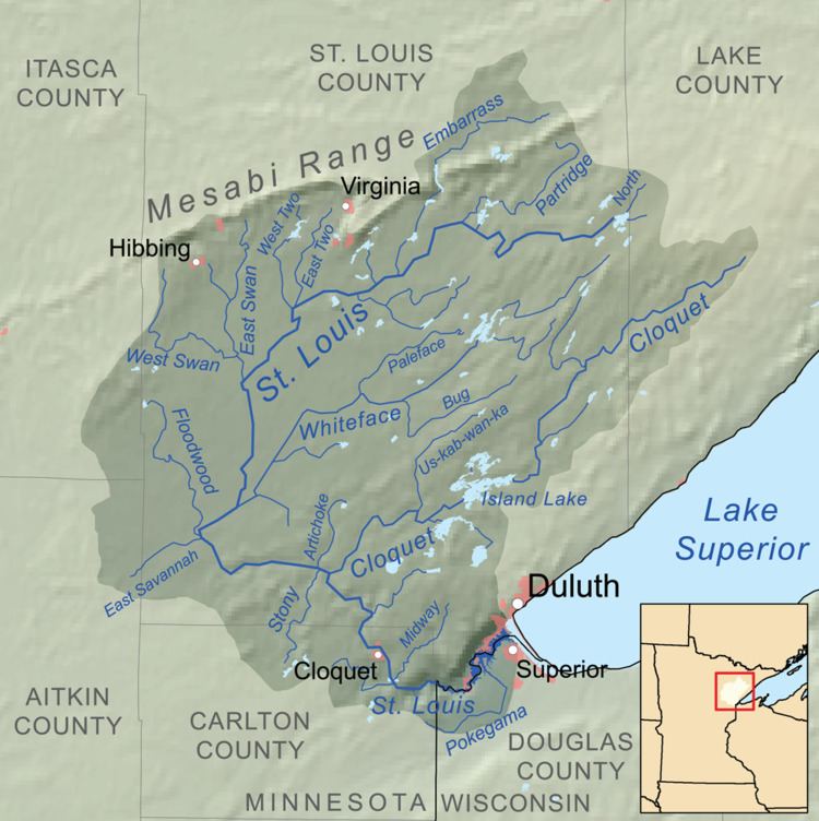
Map of Cloquet River, Minnesota, USA
Cloquet river duluth mn
NameEdit
Cloquet (/kloʊˈkeɪ/ kloh-KAY) River was known in the Ojibwe language as the Gaa-biitootigweyaag-ziibi ("River that parallels the Saint Louis River"). On the map of Stephen H. Long's expedition in 1823, it shows that stream as "Rapid River", and it is unnamed on the map by David Thompson in 1826 for the proposed routes of the international boundary. However, on the 1843 Joseph N. Nicollet map, the river is identified by its present name.
GeographyEdit
The Cloquet River generally flows in a southwesterly direction through Indian Lake, Alden Lake, and Island Lake, before emptying into the Saint Louis River.
One can separate the river into two primary stretches, the upper stretch beginning at Cloquet Lake in Lake County as a small stream and ending at Island Lake.
Tributaries of the Cloquet River include the Us-kab-wan-ka River, the Beaver River, and Little Cloquet River.