
Country United States County Hunterdon Population 2,696 (2013) | Incorporated April 5, 1865 Zip code 08809 Mayor Janice Kovach | |
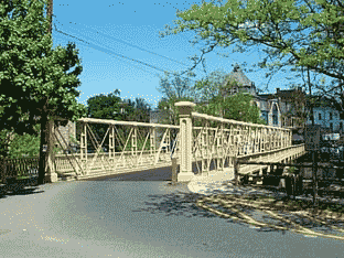 | ||
Area rank 459th of 566 in state18th of 26 in county Weather 3°C, Wind NW at 3 km/h, 78% Humidity Points of interest Red Mill, Landsdown Meadows, Hunts Mills Park | ||
Clinton is a town in Hunterdon County, New Jersey, United States, located on the South Branch of the Raritan River. As of the 2010 United States Census, the town's population was 2,719, reflecting an increase of 87 (+3.3%) from the 2,632 counted in the 2000 Census, which had in turn increased by 578 (+28.1%) from the 2,054 counted in the 1990 Census.
Contents
- Map of Clinton NJ 08809 USA
- History
- Geography
- Climate
- Census 2010
- Census 2000
- Economy
- Arts and culture
- Parks and recreation
- Local government
- Fire department
- Federal state and county representation
- Politics
- Education
- Roads and highways
- Public transportation
- Notable people
- References
Map of Clinton, NJ 08809, USA
History
When the Clinton post office was established in 1829, it was named for DeWitt Clinton, Governor of New York and the primary impetus behind the then-newly completed Erie Canal.
Clinton was incorporated as a town by an act of the New Jersey Legislature on April 5, 1865, within portions of Clinton, Franklin and Union Townships. Clinton gained full independence from its three parent townships in 1895.
The town is perhaps best known for its two mills which sit on opposite banks of the South Branch Raritan River. The Red Mill, with its historic village, dates back to 1810 with the development of a mill for wool processing. Across the river sits the Stone Mill, home of the Hunterdon Art Museum for Contemporary Craft and Design, located in a former gristmill that had been reconstructed in 1836 and operated continuously until 1936. In 1952, a group of local residents conceived of a plan to convert the historic building into an art museum, which is still in operation today.
Geography
According to the United States Census Bureau, the town had a total area of 1.417 square miles (3.670 km2), including 1.338 square miles (3.465 km2) of land and 0.079 square miles (0.205 km2) of water (5.59%).
The town borders Clinton Township, Franklin Township, and Union Township.
Clinton is considered an exurb of New York City, as Hunterdon County lies on the western fringe of the New York City Metropolitan Area, which is mainly rural with scattered housing developments and old farm homes. Clinton is part of the Primary Metropolitan Statistical Area of Middlesex, Somerset and Hunterdon counties in New Jersey. It serves as a "bedroom community" for many commuters working in and around Northern New Jersey and New York City, often younger residents who have supplanted long-time residents of Clinton.
Climate
Clinton falls under the 'Northern New Jersey' climate zone. According to the Office of the New Jersey State Climatologist at Rutgers University, the Northern climate zone covers about one-quarter of New Jersey and consists mainly of elevated highlands and valleys which are part of the Appalachian Uplands. Surrounded by land, this region can be characterized as having a continental climate with minimal influence from the Atlantic Ocean, except when the winds contain an easterly component. Prevailing winds are from the southwest in summer and from the northwest in winter. Being in the northernmost portion of the state, and with small mountains up to 1,800 feet (550 m) in elevation, the Northern Zone normally exhibits a colder temperature regime than other climate regions of the State of New Jersey. This difference is most dramatic in winter when average temperatures in the Northern Zone can be more than ten degrees Fahrenheit cooler than in the Coastal Zone. Annual snowfall averages 40 to 50 inches (1,300 mm) in the northern zone as compared with an average of 10-15 inches in the extreme south.
Clinton falls under the USDA 6b Plant Hardiness zone.
Census 2010
The 2010 United States Census counted 2,719 people, 1,057 households, and 727.2 families residing in the town. The population density was 2,032.6 per square mile (784.8/km2). The town contained 1,098 housing units at an average density of 820.8 per square mile (316.9/km2). The racial makeup of the town was 89.52% (2,434) White, 1.32% (36) Black or African American, 0.22% (6) Native American, 6.66% (181) Asian, 0.00% (0) Pacific Islander, 0.63% (17) from other races, and 1.66% (45) from two or more races. Hispanics or Latinos of any race were 6.22% (169) of the population.
Out of a total of 1,057 households, 37.0% had children under the age of 18 living with them, 55.2% were married couples living together, 9.7% had a female householder with no husband present, and 31.2% were non-families. 25.4% of all households were made up of individuals, and 8.8% had someone living alone who was 65 years of age or older. The average household size was 2.57 and the average family size was 3.14.
In the town, 26.0% of the population were under the age of 18, 6.1% from 18 to 24, 27.6% from 25 to 44, 28.8% from 45 to 64, and 11.5% who were 65 years of age or older. The median age was 39.6 years. For every 100 females the census counted 94.8 males, but for 100 females at least 18 years old, it was 92.8 males.
The Census Bureau's 2006-2010 American Community Survey showed that (in 2010 inflation-adjusted dollars) median household income was $83,850 (with a margin of error of +/- $12,019) and the median family income was $109,375 (+/- $19,698). Males had a median income of $62,697 (+/- $9,258) versus $67,014 (+/- $13,316) for females. The per capita income for the borough was $43,354 (+/- $4,395). About 2.6% of families and 3.2% of the population were below the poverty line, including 2.0% of those under age 18 and 11.9% of those age 65 or over.
Census 2000
As of the 2000 United States Census there were 2,632 people, 1,068 households, and 724 families residing in the town. The population density was 1,916.0 people per square mile (741.8/km2). There were 1,095 housing units at an average density of 797.1 per square mile (308.6/km2). The racial makeup of the town was 92.06% White, 1.33% African American, 0.46% Native American, 3.72% Asian, 1.37% from other races, and 1.06% from two or more races. Hispanic or Latino of any race were 4.10% of the population.
There were 1,068 households out of which 35.4% had children under the age of 18 living with them, 55.3% were married couples living together, 8.9% had a female householder with no husband present, and 32.2% were non-families. 26.3% of all households were made up of individuals and 7.1% had someone living alone who was 65 years of age or older. The average household size was 2.46 and the average family size was 3.00.
In the town, the population was spread out with 26.4% under the age of 18, 4.7% from 18 to 24, 35.4% from 25 to 44, 24.2% from 45 to 64, and 9.4% who were 65 years of age or older. The median age was 37 years. For every 100 females there were 95.3 males. For every 100 females age 18 and over, there were 92.3 males.
The median income for a household in the town was $78,121, and the median income for a family was $88,671. Males had a median income of $61,442 versus $46,397 for females. The per capita income for the town was $37,463. About 0.4% of families and 2.8% of the population were below the poverty line, including 0.6% of those under age 18 and 1.6% of those age 65 or over.
Economy
The construction company Foster Wheeler has its operational headquarters in Clinton.
Arts and culture
Parks and recreation
Local government
Clinton is governed under the Town form of government with a mayor and a six-member Town Council. The Mayor is directly elected by the voters to a four-year term of office. Members of the Town Council are elected to three-year terms of office on a staggered basis, with two seats coming up for election each year in a three-year cycle. The governing body is chosen at-large in partisan elections held as part of the November general election. The primary responsibilities of the Council are to serve as the legislative body of the town, approve the annual budget presented by the Mayor, approve payment of bills and serve as Liaisons to several Boards and Committees.
As of 2016, the mayor of Clinton Town is Democrat Janice Kovach, whose term of office ends on December 31, 2019. Members of the Clinton Town Council are Ken Carberry (R, 2017), Sherry Dineen (R, 2018), Marty Pendergast (R, 2017), Alfred D. Rylak (R, 2016; appointed in September 2013 to fill the vacancy of Megan Jones-Holt, who in turn had been appointed in February 2013 to fill the vacancy of Rich Duffy), Robert B. Smith (R, 2016) and Beth Sosidka (R, 2018).
Fire department
Clinton Fire Department (CFD) is located on the corner of New Street / Old Route 22 in Clinton. About 15% of the department's calls annually involve actual fire, while the rest of the CFD's calls are roughly broken down to 15% motor vehicle accidents, 15% hazardous conditions, 5% service calls, 25% good intent calls with no fire found and 25% alarm activations/false alarms, averaging about 190 calls annually. The department offers three types of membership namely Active firefighter, Junior firefighter and Associate membership to prospective members. The department runs mutual aid calls with Annandale Hose Company, High Bridge Fire Department, Quakertown Fire Company, Lebanon Fire Company and Pattenburg Fire Company and other fire departments in Hunterdon Country, which have become an invaluable resource for large incidents. The Division of Fire is a municipal fire department and is responsible for all fire related incidents in the Township. The personnel are provided by the all-volunteer Annandale Hose Company #1. There are two fire stations. One is located at 68 Beaver Avenue and the second is located at 1215 Route 31 South. Our apparatus consists of four engines, two command vehicles, one tower ladder, one tanker, and two brush trucks. The department covers an area of over 30 square miles and respond to around 500 incidents each year. The department has 45 active members who respond to calls. Each new member is trained to State Firefighter standards, and equipped to meet national standards. Our members put in hundreds of hours each year in classes, training and drills. They are always seeking volunteers not only for firefighting but also for other administrative duties.
Federal, state and county representation
Clinton Town is located in the 7th Congressional District and is part of New Jersey's 23rd state legislative district.
New Jersey's Seventh Congressional District is represented by Leonard Lance (R, Clinton Township). New Jersey is represented in the United States Senate by Cory Booker (D, Newark, term ends 2021) and Bob Menendez (D, Paramus, 2019).
For the 2016–2017 session (Senate, General Assembly), the 23rd Legislative District of the New Jersey Legislature is represented in the State Senate by Michael J. Doherty (R, Washington Township, Warren County) and in the General Assembly by John DiMaio (R, Hackettstown) and Erik Peterson (R, Franklin Township, Hunterdon County). The Governor of New Jersey is Chris Christie (R, Mendham Township). The Lieutenant Governor of New Jersey is Kim Guadagno (R, Monmouth Beach).
Hunterdon County is governed by a five-member Board of Chosen Freeholders, who serve three-year terms of office at-large on a staggered basis, with either one or two seats up for election each year on a partisan basis as part of the November general election. At an annual reorganization meeting held each January, the freeholders select one member to serve as the board's Director and another to serve as Deputy Director. As of 2015, Hunterdon County's Freeholders are Freeholder Director John King (R; Raritan Township, 2015), Freeholder Deputy Director Suzanne Lagay (R; Holland Township, 2016), J. Matthew Holt (R; Clinton Town, 2015), John E. Lanza (R; Flemington, 2016) and Robert G. Walton (R; Hampton, 2017). Constitutional officers elected on a countywide basis are County Clerk Mary H. Melfi (R; Flemington, 2017), Sheriff Fredrick W. Brown (R; Alexandria Township, 2016) and Surrogate Susan J. Hoffman (R; Kingwood Township, 2018).
Politics
As of March 23, 2011, there were a total of 1,671 registered voters in Clinton, of which 439 (26.3%) were registered as Democrats, 529 (31.7%) were registered as Republicans and 700 (41.9%) were registered as Unaffiliated. There were 3 voters registered to other parties.
In the 2012 presidential election, Republican Mitt Romney received 52.0% of the vote (693 cast), ahead of Democrat Barack Obama with 46.7% (623 votes), and other candidates with 1.3% (17 votes), among the 1,351 ballots cast by the town's 1,780 registered voters (18 ballots were spoiled), for a turnout of 75.9%. In the 2008 presidential election, Democrat Barack Obama received 49.4% of the vote (704 cast), ahead of Republican John McCain with 48.7% (694 votes) and other candidates with 1.2% (17 votes), among the 1,426 ballots cast by the town's 1,732 registered voters, for a turnout of 82.3%. In the 2004 presidential election, Republican George W. Bush received 54.8% of the vote (761 ballots cast), outpolling Democrat John Kerry with 44.0% (611 votes) and other candidates with 0.7% (12 votes), among the 1,389 ballots cast by the town's 1,671 registered voters, for a turnout percentage of 83.1.
In the 2013 gubernatorial election, Republican Chris Christie received 69.2% of the vote (577 cast), ahead of Democrat Barbara Buono with 28.1% (234 votes), and other candidates with 2.8% (23 votes), among the 840 ballots cast by the town's 1,757 registered voters (6 ballots were spoiled), for a turnout of 47.8%. In the 2009 gubernatorial election, Republican Chris Christie received 60.5% of the vote (620 ballots cast), ahead of Democrat Jon Corzine with 27.7% (284 votes), Independent Chris Daggett with 9.5% (97 votes) and other candidates with 0.7% (7 votes), among the 1,025 ballots cast by the town's 1,711 registered voters, yielding a 59.9% turnout.
Education
Clinton-Glen Gardner School District is school district based in the Town of Clinton, that serves students from Clinton Town and Glen Gardner Borough in pre-kindergarten through eighth grade at Clinton Public School. Before Glen Gardner, a non-operating district, was consolidated into the district, students from the borough had attended the district's school as part of a sending/receiving relationship. Other students attend the school on a tuition basis. Formerly known as the Town of Clinton School District, the district's board of education voted in November 2009 to revise the name to Clinton-Glen Gardner School District to reflect the merger. As of the 2014-15 school year, the district and its one school had an enrollment of 711 students and 41.8 classroom teachers (on an FTE basis), for a student–teacher ratio of 17.0:1.
Public school students in ninth through twelfth grades attend North Hunterdon High School in Annandale together with students from Bethlehem Township, Clinton Township, Franklin Township, Lebanon Borough and Union Township. As of the 2014-15 school year, the high school had an enrollment of 1,747 students and 134.8 classroom teachers (on an FTE basis), for a student–teacher ratio of 13.0:1. The school is part of the North Hunterdon-Voorhees Regional High School District, which also includes students from Califon, Glen Gardner, Hampton, High Bridge, Lebanon Township and Tewksbury Township, who attend Voorhees High School in Lebanon Township.
Roads and highways
As of July 2015, the town had a total of 12.21 miles (19.65 km) of roadways, of which 8.72 miles (14.03 km) were maintained by the municipality and 3.49 miles (5.62 km) by the New Jersey Department of Transportation.
The Town of Clinton is situated off Route 31, which is in turn off of Interstate 78/U.S. Route 22 via Exits 16 and 17. Route 173 and County Road 513 run through the center of town. Convenient access to Interstate 78 provides Clinton with a convenient route to and from New York City and the Lehigh Valley in Pennsylvania. Philadelphia can also be easily accessed from Clinton via New Jersey Route 31 to Interstate 95 South.
Public transportation
Trans-Bridge Lines offers buses on a route that provides service from Allentown and Bethlehem, Pennsylvania to the Port Authority Bus Terminal in Midtown Manhattan and New York City-area airports at a stop at the park-and-ride on Route 31 in Clinton. Limited NJ Transit Rail is also accessible at the Annandale station on the Raritan Valley Line.
Public transportation is very limited. The LINK, which serves Hunterdon County is the only traditional, publicly funded mode of transportation. Fares range from about $2.00 to $10.00. Funding for operation of the Hunterdon County LINK System is provided by Hunterdon County, NJ Transit and the Federal Transit Administration.
Notable people
People who were born in, residents of, or otherwise closely associated with Clinton include: