
Sovereign state United Kingdom Postcode district ME3 Local time Tuesday 5:31 AM | ||
 | ||
Weather 6°C, Wind W at 14 km/h, 87% Humidity | ||
Cliffe Woods is a small suburb on the Hoo Peninsula in the unitary authority of Medway in South East England. It was, until 1998, part of Kent and is still ceremonially associated via the Lieutenancies Act. It forms part of the parish of Cliffe and Cliffe Woods.
Contents
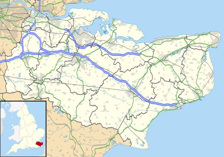
Map of Cliffe Woods, Rochester, UK
It was once just a hamlet and is situated next to Higham. The old woods rise to meet Chattenden and the Ratcliffe highway, just before Hoo, and still retains much of its rural character, but has of late been built upon. The modern estate now situated just back from the B2000 road was built on a clay subsoil, and many of the houses had to be underpinned after having been sold, because they were noticed to have moved slightly, built on a hillside.
A petrol filling station was one of the few village shops here as early as 1925, and was rebuilt in the 1960s. Even then some of the properties in the woods did not have their own water supply, and had to visit the garage to collect their water. In the mid-1990s, the petrol station closed, and was not reopened; however the estate saw a community center, doctors' surgery and pharmacy open.
The railway station was never busy and very quaint. Trains came from Waterloo at least hourly and were mainly of the old slam door type with drop down windows located with a leather strap. There was a pub just on the corner from the railway, and it was usually quiet in the early 1960s.
In the 1950s and 1960s View Road was a bumpy unmade track and was lined with trees. There was a small one room hovel/house/shed halfway up on the right, with someone living in it. There were several very large plots nearer the top just at the base of the hill to the woods. At least one was purchased before or during the war and used unofficially for living in until it was compulsorily purchased in the late 1960s. The owner believed that there was council interest and could never get planning permission for a proper house. The original plots were demolished about 1968/9.
At least some of the plots had electricity (from the early 1950s at least), mains water and a septic tank. Most people had a paraffin stove used for cooking and also lighting when the electric failed. The petrol station was still the only shop in the early 1960s.
In the early 1960s, at the top of View Road there were woods stretching almost to the river, with wild cobnuts, and chestnuts too. There were wild damsons in the area, and apple trees were planted and mature by the 1950s.
History
Cliffe Woods is a village that has been built in an ancient area of woodland. Its roots are closely tied to the surrounding area which stretch back to pre-Roman times. At the time of the Norman conquest of England Cliffe Woods was part of the Hundred of Shamwell. Of the adjacent listed Domesday Book settlements, Cooling, Oakleigh and Haven, only Cooling had any recorded woodland resources in its inventory. The woods were used for the pannage of pigs; ten pigs a year were paid to Wulfwin the local Anglo Saxon Lord. His Germanic name means wolf-friend. The Anglo Saxon overlord was Leofwine Godwinson who was the brother of King Harold.
According to Edward Hasted (1732-1812), the father of Kent history, ‘Southward of the common field, on the road to Rochester, the land rises to the hilly country, a poor clayey soil likewise, where is the manor of Mortimer’s, at the southern boundary of this parish. The manor was in the possession of the great family of Mortimer, Hugh de Mortimer was in possession of the manor in the reign of Edward I of England' (1239-1307).
The naming of Mortimer’s Wood and subsequently Mortimer’s Avenue can be associated from its connection to the old manor. Some other road names in the eastern part of Cliffe Woods are also historically connected to the manor. For example Englefield Crescent is named after Thomas Englefield (1455-1514) the Speaker of the House of Commons in the reign of Henry VII of England; he also owned Mortimer's.
Burye-Court Manor (associated with Berry Court Wood) was granted to George Brooke, 9th Baron Cobham in 1541 by Henry VIII of England. His grandson Henry Brooke, 11th Baron Cobham lost the manor in 1603 after being convicted of treason against James VI and I, which resulted in his imprisonment in the Tower of London.
Tithe records from the middle of the 19th century show that 36 acres of Mortimer’s Wood were owned by the trustees of the 5th Earl of Darnley. Robert Turberville Bingham of Rochester owned 23 acres of Lady’s Close and Ratly Hill Wood, the name is associated with Bingham Roughs. Based at Cobham Hall the Darnley’s were major landowners in the area, the Cobham Estate fell into decline at the beginning of the 20th century. There were no buildings in Cliffe Woods in 1870. The different areas of woodland were named (from west to east) Mortimers Wood, Ladies Close, Ratly Hills Woods, Bingham Roughs, Berry Court Wood, Great Chattenden Wood, Ash Wood, Stone House Wood and Round Top Wood near Chattenden. Ladies Close is today associated with Ladyclose Avenue. Cooling Common (now Merry Boys Road) referred to common land and in 1797 Hasted referred to the common field which indicates not all land had been enclosed by that time.
In 1870, the adjacent buildings to Cliffe Woods were;
After World War I (1914-1918) the area now covered by the newer housing was divided into woodland plots and called the Rochester Park Estate. The Rochester Park and Garden Suburb was a ‘plotland’ settlement, part of a wider movement at the time of unregulated development. W H Talbot parcelled up and sold plots between 1918 and 1939. This resulted in a haphazard layout of small buildings and chalets served by a network of unmade tracks; with poor water, electricity and sewer connections. Two tracks were named Milton and Tennyson Avenues after the poets John Milton and Alfred Lord Tennyson. The plots here were mainly used for summer leisure purposes. The author Lena Kennedy (1914-1986) describes in her autobiography 'Away to the Woods' her experiences of living on a woodland plot. Inspired by Charles Dickens (1812-1870), who lived nearby at Higham, she based some of her romantic historical novels in the area. A blue plaque is sited on her plotland shack in View Road.
Town Road, Mortimers Avenue and Ladyclose Avenue developed a permanent population before World War II (1939-1945). Pre-war chalet bungalows were built. They had electricity (1936), running water and heating and hot water provided by log stoves. Sewage was by septic tank until the main drainage was constructed by 1963.
During World War II many pillboxes were constructed as part of the home defences. A Stop Line was constructed in 1940 across the Hoo Peninsula from the Medway to the Thames which ran through Cliffe Woods. Being on the flight path to London many bombs fell and their craters are still evident in the landscape. On 11 November 1944 at 3.40 pm a V2 rocket fell in Ratly Hill Wood and completely destroyed trees in a 17-metre radius.
In the 1950s local children attended school at Cliffe or walked to Cooling Street where the school was an in old Methodist Chapel built in 1899. It was known as the chapel in the orchard. The Alpha cement factory owned by APCM provided local employment until it closed in 1970. Cement making had begun at Cliffe in 1854 in a bottle kiln. Women worked seasonally picking fruit, local growers used the railway to transport their goods to market.
The Maidstone & District bus service (service number 17) provided transport from Cliffe Woods into Cliffe and the Medway towns for provisions. Cliffe station on the Hundred of Hoo railway line (1 April 1882 to 4 December 1961) lay less than a mile north of the village. It transported passengers to Gravesend and to the seaside at Allhallows. On 10 February 1967 Strood Rural District Council made a compulsory purchase order to buy 86 acres of land to the east of Town Road. The purpose was to provide a comprehensive development by the erection of shops, community centre and dwelling houses. The building of the new community commenced in the 1970s and the park and garden suburb envisaged in the naming of the old plotland site became a reality. Today over 90% of residents own their houses. The population of Cliffe Woods at the census of 27 March 2001 was 2662, in 1801 only 525 people lived in the entire parish.